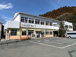
Population 5,979 (Nov 2014) | - Tree Japanese Red Pine Local time Monday 11:06 AM | |
 | ||
Weather 11°C, Wind NE at 11 km/h, 40% Humidity Points of interest Yamatsuriyama Park, Yamatsuriyama, Hiyama | ||
Yamatsuri (矢祭町, Yamatsuri-machi) is a town located in Higashishirakawa District, Fukushima Prefecture, in northern Honshū, Japan. As of November 2014, the town had an estimated population of 5,979 and a population density of 50.6 persons per km². The total area was 118.22 km².
Contents
- Map of Yamatsuri Higashishirakawa District Fukushima Prefecture Japan
- Geography
- Neighboring municipalities
- History
- Economy
- Primary schools
- Junior High school
- Railway
- Highway
- International relations
- References
Map of Yamatsuri, Higashishirakawa District, Fukushima Prefecture, Japan
Geography
Yamatsuri is located in the southernmost portion of Fukushima prefecture, bordering on Ibaraki Prefecture to the south.
Neighboring municipalities
History
The area of present-day Yamatsuri was part of ancient Mutsu Province. The area formed part of the holdings of Tanagura Domain, in the early Edo period, but became was tenryō territory under direct control of the Tokugawa Shogunate after 1729. After the Meiji Restoration, it was organized as part of Nakadōri region of Iwaki Province.
Yamatsuri Village was formed on March 31, 1955 by the merger of the villages of Uchikawa and Sekioka and a portion of the village of Takagi. It was elevated to town status on January 1, 1963.
Economy
The economy of Yamamtsuri is primarily agricultural.
