
Subregion Subnorte Elevation 650 m Local time Sunday 4:20 PM | Founded 13 March 1623 Area 329 km² Population 8,952 (2015) | |
 | ||
Founded by Francisco Gómez Quintero Weather 30°C, Wind NE at 10 km/h, 59% Humidity | ||
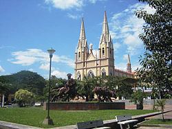
Yaguará ([ʝaɣwaˈɾa]) is a town and municipality in the Huila Department, Colombia. The urban centre is located at an altitude of 650 metres (2,130 ft) in the Magdalena River Valley and the Eastern Ranges of the Colombian Andes. The municipality borders Teruel and Palermo in the north, Gigante, Hobo and Tesalia in the south, Campoalegre and Hobo in the east and Tesalia and Iquira in the west. The departmental capital Neiva is 49 kilometres (30 mi) to the northeast. The Betania Reservoir is situated within the boundaries of Yaguará.
Contents
Map of Yaguara, Huila, Colombia
Etymology
The name Yaguará is derived from the jaguar.
History
In the time before the Spanish conquest, the region of Yaguará was inhabited by the Páez. They defended their territory against the Pijao, who came from nearby Tolima and later against the Spanish conquistadors.
Modern Yaguará was founded on March 13, 1623 by Francisco Gómez Quintero, under command of the governor of Neiva Diego de Ospina y Medinilla.
Paleontology
Fossils of the Late Cretaceous (Turonian) mosasaur Yaguarasaurus were found in the La Frontera Formation in Yaguará and the species was named after the town.