
West end: US 212 Counties: Park West end US 212 | East end: WYO 120 Length 73.97 km East end WYO 120 | |
 | ||
Chief joseph scenic byway
Wyoming Highway 296 also known as the Chief Joseph Scenic Byway is in the U.S. state of Wyoming and follows the route taken by Chief Joseph as he led the Nez Perce Indians out of Yellowstone National Park and into Montana in 1877 during their attempt to flee the U.S. Cavalry and escape into Canada.
Contents
- Chief joseph scenic byway
- Map of State Hwy 296 Cody WY 82414 USA
- Route description
- Major intersections
- References
Map of State Hwy 296, Cody, WY 82414, USA
Route description
Wyoming Highway 296 is a 45.96-mile (73.97 km) long scenic highway in northern Park County. Highway 296 begins its western end at U.S. Route 212 (Beartooth Highway) fourteen miles southeast of Cooke City, Montana. WYO 296 travels southeasterly as it winds through the Shoshone National Forest and through the Absaroka Mountains and then passes through Dead Indian Pass. After almost 46 miles, WYO 296 reaches its eastern end at Wyoming Highway 120, 17 miles north of Cody.
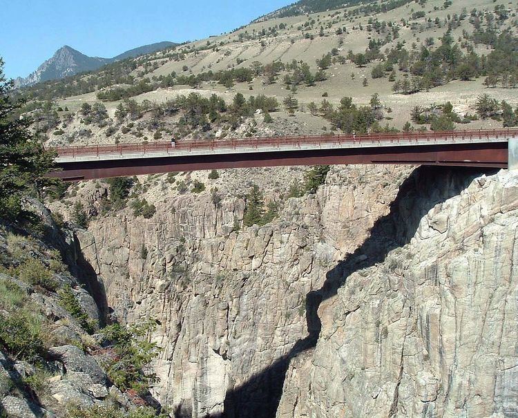
Highway 296 crosses Sunlight Creek Bridge, the highest in Wyoming.
Major intersections
The entire route is in Park County.