
Length 2.96 km | ||
 | ||
West end: I-25 Bus. / US 85 / US 87 Bus. in Cheyenne. | ||
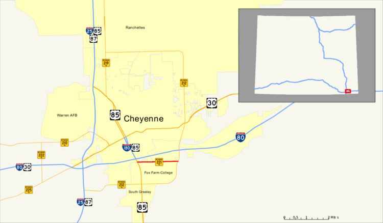
Wyoming Highway 221 was a 1.84-mile (3.0 km) east–west Wyoming State Road known as Fox Farm Road located in southeastern Cheyenne.
Contents
Map of State Hwy 221, Cheyenne, WY 82007, USA
Route description
Wyoming Highway 221 traveled from I-25 Business/US 85/US 87 Business (South Greeley Highway) to Wyoming Highway 212 (College Avenue). Highway 221 paralleled Interstate 80 about one-half mile south of the Interstate and served residential and commercial areas. The route was decommissioned in 2009; all state route marker signs have been removed, and the route no longer appears on the Wyoming Official State Highway Map.
Major intersections
The entire route is in Cheyenne, Laramie County.
References
Wyoming Highway 221 Wikipedia(Text) CC BY-SA