
Length 24.7 mi (39.8 km) | ||
 | ||
Location Columbia and Richmond counties Majorjunctions US 221 / SR 47 north of Harlem SR 223 / SR 388 at Harlem–Grovetown Road in Grovetown SR 388 at Katherine Street in Grovetown SR 383 west of Augusta I‑520 in Augusta East end James Brown Boulevard in Augusta | ||
Wrightsboro Road is a 24.7-mile-long (39.8 km) major road in the east-central part of the U.S. state of Georgia, traveling through southern Columbia and northeastern Richmond counties. At its western end, it is fairly rural, but at its eastern end, it is an urban corridor of the Augusta metropolitan area. It connects rural areas of southwestern Columbia County with Grovetown and Augusta. It also serves as the main entry point to Augusta Mall. From its western terminus, east-northeast of Thomson, to Grovetown, it is signed as part of Georgia State Route 223 (SR 223). In Grovetown, it is signed as part of SR 388. East of Grovetown, it is an unnumbered highway.
Contents
- Map of Wrightsboro Rd Georgia USA
- Columbia County
- Richmond County
- National Highway System
- History
- References
Map of Wrightsboro Rd, Georgia, USA
It was named after Wrightsboro, a settlement formed in 1768 by British Royal Governor James Wright. It was a settlement for displaced Quakers from North Carolina. Later, Thomson, Dearing, and Wrightsboro were merged with parts of Warren County to form McDuffie County.
Columbia County
Wrightsboro Road begins at an intersection with Georgia State Route 223 (SR 223) and Hinton Wilson Road, east-northeast of Thomson, in Columbia County. West-northwest of this intersection, SR 223 has the local name of East White Oak Road. At this intersection, SR 223 assumes Wrightsboro Road as its local street name. They then cross over Kiokee Creek and have a slight northward jog before continuing to the southeast. Approximately 0.5 miles (0.80 km) later, they intersect US 221/SR 47 (Jake Pollard Highway). SR 223/Wrightsboro Road then curve to a more east-southeasterly routing and cross over Little Kiokee Creek. Then, they travel just south of Euchee Creek Elementary School and Euchee Creek Library. A short distance later, the roadway crosses over the northern terminus of the Grovetown Trails at Euchee Creek, briefly skirting along the northwestern city limits of Grovetown in the process. A few hundred feet later, the road crosses into Grovetown proper and has an intersection with Harlem–Grovetown Road. This intersection also marks the southern terminus of SR 388, which takes on the Wrightsboro Road name, while SR 223 continues known as East Robinson Avenue. SR 388/Wrightsboro Road travel to the left and in a northeasterly direction, before curving to the east. Along the way, the roadway is lined with numerous retail businesses on both sides of the road. They also travel along the southeastern edge of Goodale Park. They serve as one of the most important thoroughfares in the area. At an intersection with Katherine Street, SR 388 travels to the north-northeast, known as Horizon South Parkway, while Wrightsboro Road continues to the east. It leaves the city limits just before passing by the Grovetown post office. Then, it transitions into more of a residential roadway and begins to gradually turn to the northeast. Just to the east of Bellevue Memorial Gardens, a cemetery, it curves back to the east-southeast and intersects SR 383 (Jimmy Dyess Parkway). Immediately after this intersection, the road enters Richmond County and the city limits of Augusta.
Richmond County
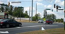
As soon as the road travels through the SR 383 intersection, it curves to the south-southeast and immediately curves to an easterly direction, narrowing from four lanes to two. It travels north of Sue Reynolds Elementary School and then makes a gradual curve to the southeast. At the eastern terminus of Belair Road, Wrightsboro Road curves to the east-northeast and transitions into a more business-oriented roadway. It has an intersection with Augusta West Parkway, which serves as a frontage road for the western side of Interstate 520 (I-520). After that intersection, Wrightsboro Road has an interchange with the Interstate highway itself. Immediately after this interchange are two entrance roads to Augusta Mall. An intersection with Marks Church Road, which serves as a frontage road for the east side of I-520, as well as Garden Spring Lane, which also leads to the mall, is next. Just after this intersection, is an intersection with Capps Road, which is the last road off Wrightsboro Road to lead to the mall. From I-520, Wrightsboro Road is littered with businesses on both sides of the highway. At the intersection with North Leg Road and Jackson Road, Wrightsboro travels just south of Copeland Elementary School. Three blocks later, it skirts along the southern edge of Georgia Regents University's (GRU) Forest Hills campus and Forest Hills Golf Club. Then, it skirts along the northern edge of the Augusta Municipal Golf Course and Daniel Field, a public use airport. Just past Daniel Field, Wrightsboro Road travels between GRU's Summerville campus and Charlie Norwood VA Medical Center. The roadway skirts along the south edge of Monte Sano Elementary School. It travels just south of Paine College. On the southwest corner of GRU's main campus, Wrightsboro Road passes under, but does not have an intersection with, SR 4 (15th Street/Ruth B. Crawford Highway), although there is a ramp that leads to Wrightsboro Road. It then curves to the southeast, passing just to the southwest of Lucy Craft Laney High School, C. T. Walker Traditional Magnet School, and A. R. Johnson Health Science and Engineering Magnet High School. Just over 1,000 feet (300 m) later, the roadway meets its eastern terminus, at an intersection with James Brown Boulevard, just before that road transitions into Nicholas Street.
National Highway System
The only sections of Wrightsboro Road that are part of the National Highway System, a system of roadways important to the nation's economy, defense, and mobility, are as follows:
History
In the fall of 2012, Reeves Construction Company of Macon was awarded a contract to widen Wrightsboro Road from two to four lanes between Jimmy Dyess Parkway and I-520. This was partially done to protect Flowing Wells Spring, a historic spring that was built to provide water to Sue Reynolds Elementary School.