
Postcode(s) 5271 | Time zone ACST (UTC+9:30) Postal code 5271 | |
 | ||
Wrattonbully is a locality located within the Naracoorte Lucindale Council in the Limestone Coast in the south east of South Australia about 327 kilometres (203 mi) south east of the Adelaide city centre. Wrattonbully gives its name to the wine region surrounding it, the Wrattonbully wine region.
Map of Wrattonbully SA 5271, Australia
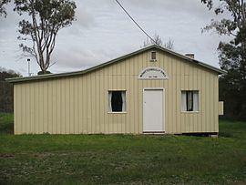
Wrattonbully was established following World War II in 1946 as a soldier settlement scheme. Seventeen farms were allocated to returned soldiers. The community hall was established in 1958. Wrattonbully shares a single CFS brigade with the neighbouring locality of Joanna.
References
Wrattonbully, South Australia Wikipedia(Text) CC BY-SA