
Length 2 km | Basin size 3.2 km (1.2 sq mi) Basin area 3.2 km² | |
 | ||
Main source Source: Drainage channel from the Wormke747 m above sea level (NN) Progression | ||
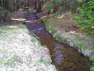
The Wormsgraben is a waterway in the Harz Mountains of central Germany in the state of Saxony-Anhalt.
Contents
Map of Wormsgraben, Germany
Location
The Wormsgraben is located 1 to 3 km west of Drei Annen Hohne and 1 km south of the Hohneklippen rocks. The River Wormke, which empties into the Kalte Bode near Mandelholz, is in its upper reaches fed through a weir into the Wormsgraben. Initially most of the river's waters were diverted into the Wormsgraben channel, today all the water flows this way. After the Wormsgraben is crossed by the Glashütten Way (Glashüttenweg i.e. Glassworks Way) at the Sandgrube, it discharges into the Zillierbach near the forest lodge of Hohne. The artificial ditch drains the water of the Bode and leads it to the catchment area of the Zillierbach-Holtemme, in order to transfer it after 48 km to the Bode in the northern Harz Foreland. Due to a steep gradient and high rate of flow a high (up to 1 m) and wide embankment is needed on the downhill side of the channel.