
Topo map USGS Jacks Gap Elevation 1,390 m | First ascent unknown Prominence 61 m Easiest route Hiking | |
 | ||
Similar Double Spring Knob, Dick's Knob, Slaughter Mountain, Jacks Knob, Coosa Bald | ||
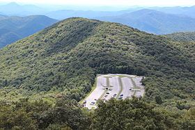
Wolfpen Ridge is a ridge in the Blue Ridge Mountains in U.S. state of Georgia that runs south to north along the boundary between Towns and Union counties. Brasstown Bald, the highest point in Georgia, is located at the northern end of the ridge (elevation: 4,786 feet (1,459 m)). At the southern end of the ridge, there is an unnamed peak with an elevation of 4,561 feet, which makes it the fifth-highest point in Georgia.
Map of Wolfpen Ridge, Georgia 30546, USA
References
Wolfpen Ridge Wikipedia(Text) CC BY-SA