
- elevation 827 ft (252 m) Basin area 641.8 km² | - elevation 1,181 ft (360 m) Basin area 641.8 km² | |
 | ||
Mouths | ||
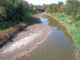
The Wolf River is a 45.7-mile-long (73.5 km) tributary of the Missouri River in northeastern Kansas in the United States, draining an area of 247.8 square miles (642 km2) in the Dissected Till Plains region.
Contents
Map of Wolf River, Kansas, USA
It rises in Brown County, approximately 3 miles (4.8 km) north of Powhattan, and flows generally eastwardly into Doniphan County, past the communities of Robinson, Leona, and Severance. Near Severance, the river turns northward; it flows into the Missouri River approximately 8 miles (13 km) southeast of White Cloud.
According to a 2001 study by the Kansas Department of Health and Environment, 71% of the Wolf River watershed is cropland, 25% is grassland, 3% is woodland, and 0.5% is urban.
Variant namesEdit
According to the Geographic Names Information System, the Wolf River has also been known historically as: