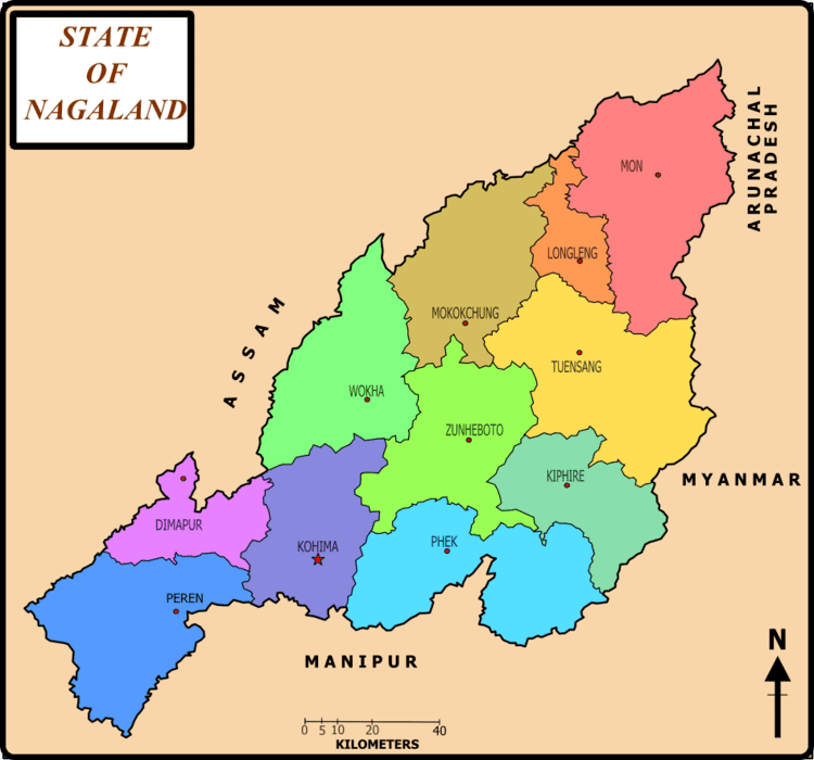
Sneha Girap (Editor)

Wokha

Updated on
Edit
Like
Comment
Share on FacebookTweet on TwitterShare on LinkedInShare on Reddit
Country
  
India

Language spoken
  
English

State
  
Nagaland

District
  
Wokha

Image result for Wokha

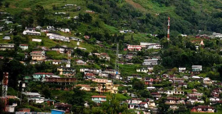
'Wokha is a town and a town area committee in Wokha district in the Indian state of Nagaland. It is the third largest town in Nagaland. The word Wokha is derived from the Lotha language word for census. It is the district headquarters of Lotha Nagas, who commonly call themselves Kyong. Wokha is situated just below the legendary Naga Mountain peak of Mount Tiyi (elevation 1968 m).

Contents

Map of Wokha

Beautifully hand crafted wooden hornbill at wokha nagaland


Shri wokheshwar nath mandir in christian dominated nagaland wokha town


History

Wokha in the past, History of Wokha

In 1876 the British Government occupied Wokha as the district headquarters of the Naga Hills under Assam. By 1878 the headquarters was shifted to Kohima, but Wokha remained a subdivision. Later in 1889 the subdivision was shifted to Mokokchung. In 1957 Wokha became a subdivision again.

Geography and climate

Wokha Beautiful Landscapes of Wokha

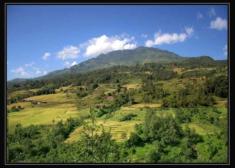
Wokha is located at 26.1°N 94.27°E? / 26.1; 94.27 at an average elevation of 1,313 metres (4,793 feet). It has a warm temperate climate (classified as Cwa by Koppen and Geiger). The summer temperature of Wokha ranges from 16.1 °C to 32 °C. The winter temperature reaches a minimum of 2 °C. The average annual temperature in Wokha is 17.8 °C. The average annual rainfall is 1940 mm.

Tourism

Wokha Tourist places in Wokha

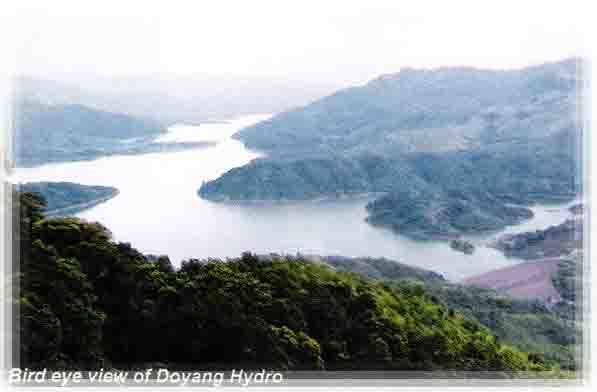
Wokhas agglomeration consists of Wokha town, Longsa village, Wokha village and Vakhosung. It has a combined population of over 80,000. Wokha is on the main route from Kohima to Mokokchung and was one of the earliest locations of the Assam Rifles. The Government of Nagaland constructed a tourist lodge in Wokha Town. The annual Amur falcon migration passes Doyang Dam, which is a 2 hour drive away. It also hosts the oldest cricket tournament in North East India, The Winter Cricket Challenge. The nearest railhead is Furkating Railway Station in Golaghat, Assam and the nearest airport is Dimapur Airport (IATA: DMU, ICAO: VEMR). Taxis and buses are available from every district headquarter in Nagaland to Wokha. There is a helicopter service from Dimapur.

References

Wokha Wikipedia (,)http://upload.wikimedia.org/wikipedia/commons/3/30/Nagalandmap.png(,)http://upload.wikimedia.org/wikipedia/commons/c/cc/Early_nagas.JPG(,)http://www.kolkatabirds.com/hillbirdsofind/nagalandtrip2.jpg(,)http://kanglaonline.com/wp-content/uploads/2015/03/nine-month-old-baby-boy-victim-of-wokha-bomb-blast-1045x780.jpg(,)http://www.dbcmaram.org/files/2011/10/IMG_8107.jpg(,)http://i.ytimg.com/vi/L4mQd0xUqmk/0.jpg(,)http://newswatch.nationalgeographic.com/files/2013/11/Amur-numbers-1.jpg(,)http://i.ytimg.com/vi/MtJUb4WRYsg/0.jpg(,)http://www.easternmirrornagaland.com/wp-content/uploads/2015/03/page1-march-27-500x330.jpg(,)http://mw2.google.com/mw-panoramio/photos/medium/38475354.jpg(,)http://i.ytimg.com/vi/GrHntb00pAU/0.jpg(,)http://i1.trekearth.com/photos/97563/6068.jpg(,)http://wildventures.com/images_landscapes/kids-poster-landscape(,)http://farm9.static.flickr.com/8518/8488845189_4d5e7c963a_m.jpg(,)http://farm9.static.flickr.com/8401/8757155152_a612996eec_m.jpg(,)http://sevendiary.com/wp-content/uploads/2013/11/Amur-falcons-near-the-Doyang-reservoir-in-Wokha-district-of-Nagaland..jpg(,)http://maps.maphill.com/india/nagaland/wokha/location-maps/physical-map/physical-location-map-of-wokha.jpg(,)http://maps.maphill.com/india/nagaland/wokha/maps/physical-map/darken/darken-physical-map-of-wokha.jpg(,)http://maps.maphill.com/india/nagaland/wokha/panoramic-maps/physical-map/darken/darken-physical-panoramic-map-of-wokha.jpg(,)http://maps.maphill.com/atlas/26n20-94e25/maps/physical-map/physical-map-of-26n20-94e25.jpg(,)http://im.hunt.in/cg/nag/About/Tourism/wokha.jpg(,)http://www.asiantribune.com/sites/asiantribune.com/files/images/2012/Home%2520Minister%2520visits%2520wokha%2520blast%2520site.jpg(,)http://www.asiantribune.com/sites/asiantribune.com/files/images/2012/Home%2520Minister%2520was%2520shown%2520the%2520bomb%2520explosion%2520site%2520at%2520Wokha%2520%2520%2520%2520%2520in%2520the%2520completely%2520damaged%2520building%2520by%2520DIP%2520Ops.jpg(,)http://indpaedia.com/ind/images/b/b4/Miss_Wokha_2012.jpg(,)http://www.thehindu.com/multimedia/dynamic/01642/TH04_3_AMUR_FALCON_1642865f.jpg(,)http://f.tqn.com/y/goindia/1/S/i/Q/-/-/wokhamarket.jpg(,)http://www.malayaleehouse.com/uploads/thumbs/164682fb9-1.jpg(,)http://indpaedia.com/ind/images/e/e1/Wokha_open_air_concert.jpg(,)http://industrialtour.com/wp-content/themes/directorypress/thumbs//Wokha.jpg(,)http://i.ytimg.com/vi/TdfWiwl6f7M/hqdefault.jpg(,)http://i1.trekearth.com/photos/154847/ssa52749.jpg(,)http://wokha.nic.in/IMAGES/doyang.jpg(,)http://cdn.indiatourism4u.in/images/12803.jpg(,)http://www.waytoindia.com/cityimage/Wokha.png(,)http://img1.holidayiq.com/photos/mo/Mokokchung-8162-0-jpg-uploadimages-travel-619x240-1334922396-cropped.jpg(,)http://www.holidayiq.com/images/attractions/1346779272_12271.jpg(,)https://tmi2-tourmyindiapvtlt.netdna-ssl.com/blog/wp-content/uploads/2015/02/Wokha.jpg(,)http://wokha.nic.in/IMAGES/chubi3.gif(,)http://im.hunt.in/cg/nag/About/Tourism/dn.JPG