
Elevation 1,152 m Age of rock Devonian Parent range Burroughs Range | Prominence 61 m Topo map USGS Phoenicia | |
 | ||
Similar Cornell Mountain, Slide Mountain, Peekamoose Mountain, Panther Mountain, Balsam Cap | ||
Wittenberg Mountain is a mountain located in Ulster County, New York. The mountain is part of the Burroughs Range of the Catskill Mountains. Wittenberg is flanked to the southwest by Cornell Mountain.
Contents
- Map of Wittenberg Mountain Shandaken NY 12464 USA
- Hiking slide mountain via cornell and wittenberg mountains catskill mountains
- References
Map of Wittenberg Mountain, Shandaken, NY 12464, USA
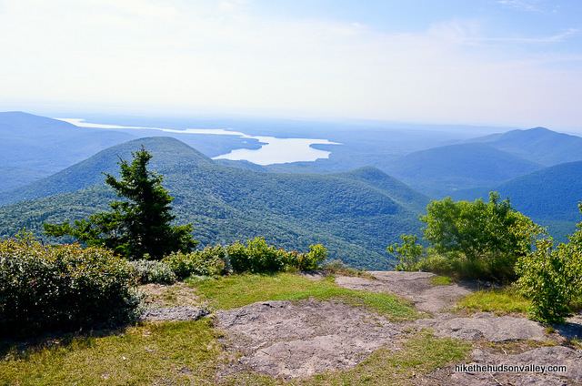
Wittenberg Mountain stands within the watershed of Esopus Creek, which drains into the Hudson River, and into New York Bay. The northwest and northeast slopes of Wittenberg Mtn. drain into Woodland Creek, thence into Esopus Creek. The southeast side of Wittenberg drains into Wittenberg Brook, thence into Maltby Hollow Brook, Bush Kill, and Esopus Creek at Ashokan Reservoir.
Wittenberg Mountain is within the Slide Mountain Wilderness of New York's Catskill State Park. The Long Path, a 350-mile (560 km) long-distance hiking trail from New York City to Albany, is contiguous with the section of the Burroughs Range Trail crossing the summits of Slide, Cornell, and Wittenberg.