
Topo map USGS Phoenicia | Prominence 183 m Parent range Burroughs Range | |
 | ||
Elevation 3860+ feet (1177+ m) NGVD 29 Similar Wittenberg Mountain, Slide Mountain, Balsam Cap, Peekamoose Mountain, Table Mountain | ||
Wittenberg cornell mountain 8 85 mile hike
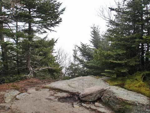
Cornell Mountain is a mountain located in Ulster County, New York. The mountain is part of the Burroughs Range of the Catskill Mountains. Cornell Mountain is flanked to the northeast by Wittenberg Mountain, to the southwest by Friday Mountain, and to the west by 4,180-foot (1,270 m) Slide Mountain — the highest peak in the Catskills.
Contents
- Wittenberg cornell mountain 8 85 mile hike
- Map of Cornell Mountain Shandaken NY 12464 USA
- Hiking wittenberg and cornell mountains catskills ny 9 9 2012
- References
Map of Cornell Mountain, Shandaken, NY 12464, USA
The northwest side of Cornell Mountain drains into Woodland Creek, thence into Esopus Creek, the Hudson River, and into New York Bay. The east and southeast sides of Cornell Mtn. drain into the Wittenberg Brook, thence into Maltby Hollow Brook, Bush Kill, and Esopus Creek. The southwest side of Cornell Mtn. drains into the headwaters of the east branch of the Neversink River, thence into the Delaware River, and into Delaware Bay.
Cornell Mountain is within the Slide Mountain Wilderness of New York's Catskill State Park. The Long Path, a 350-mile (560 km) long-distance hiking trail from New York City to Albany, is contiguous with the section of the Burroughs Range Trail crossing the summits of Slide, Cornell, and Wittenberg.