
Admin. region Köln Population 1,876 (28 Feb 2005) | Highest elevation 280 m (920 ft) Area code 02268 | |
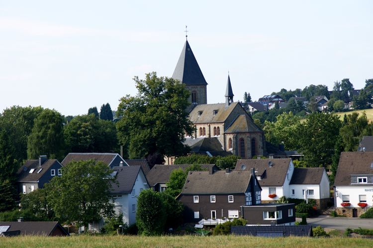 | ||
Wipperfeld is a village and a district in the town of Wipperfürth which is a Northrhine-Westphalian municipality in the Oberbergischer Kreis, about 40 km north-east of Cologne.
Contents
- Map of Wipperfeld 51688 WipperfC3BCrth Germany
- Geographical position
- The district Wipperfeld
- History
- Mediaeval Times
- Modern Times
- Parish Churches
- Schools
- Federal roads
- Bus routes
- German
- References
Map of Wipperfeld, 51688 Wipperf%C3%BCrth, Germany
Geographical position
Wipperfeld is set in the west of Wipperfürth, next to the federal road B506 from Wipperfürth to Bergisch Gladbach.
Villages proximate to Wipperfeld are Lamsfuß, Erlen, Grüterich, Überberg and Oberholl.
The river "Wipperfelder Bach" runs through the village.
The district Wipperfeld
The district Wipperfeld consists of the following villages:
History
The village was first mentioned as Wippervelde in the year of 1300.
Mediaeval Times
In mediaeval times the village formed a part of the department of Steinbach (Lindlar) and belonged to the district of the country court in Lindlar.
The parish church of Wipperfeld was built in the 12th century. The present-day church was built in 1892 and consecrated in 1894.
Modern Times
Up unto the 19th century a flour mill was in operation. The mill is identified in the "Statistik des Bergischen Landes von 1797".
In 1890 Mr Mausbach from Wipperfeld was elected as the mayor of Lindlar.
Up to 1975 an independent municipality of Wipperfeld existed.
Parish Churches
Schools
Federal roads
The federal road B506 from Wipperfürth to Bergisch Gladbach runs next to Wipperfeld.
Bus routes
Bus stops Wipperfeld, Wipperfeld, Wende, Wipperfeld, Kirche: