
FIPS code 55-87925 Elevation 228 m Population 2,383 (2010) | Time zone Central (CST) (UTC-6) GNIS feature ID 1584458 Area 5.05 km² Area code(s) 920 | |
 | ||
Weather 6°C, Wind N at 14 km/h, 94% Humidity | ||
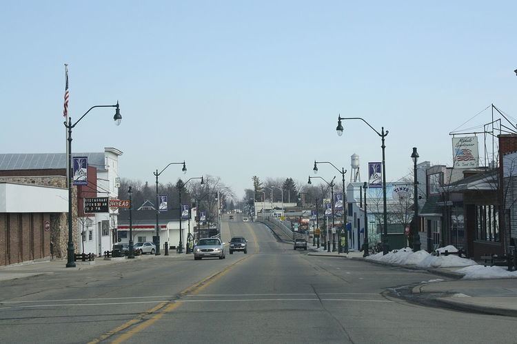
Winneconne is a village in Winnebago County, Wisconsin, United States. The population was 2,383 at the 2010 census. The village is located within the Town of Winneconne. The Wolf River runs through the village.
Contents
Geography
Winneconne is located at 44°6'39" North, 88°42'51" West (44.111029, -88.714311).
According to the United States Census Bureau, the village has a total area of 1.95 square miles (5.05 km2), of which, 1.53 square miles (3.96 km2) of it is land and 0.42 square miles (1.09 km2) is water.
The city was built along the banks of the Wolf Chain, which includes Lake Poygan, Lake Winneconne, and Lake Butte des Morts. Many bass fishing tournaments are held out of Winneconne due to its central location on the chain, despite the lack of a healthy bass population in the chain.
2010 census
As of the census of 2010, there were 2,383 people, 1,027 households, and 678 families residing in the village. The population density was 1,557.5 inhabitants per square mile (601.4/km2). There were 1,198 housing units at an average density of 783.0 per square mile (302.3/km2). The racial makeup of the village was 97.5% White, 0.2% African American, 0.4% Native American, 0.3% Asian, 0.8% from other races, and 0.8% from two or more races. Hispanic or Latino of any race were 1.3% of the population.
There were 1,027 households of which 29.4% had children under the age of 18 living with them, 54.3% were married couples living together, 7.5% had a female householder with no husband present, 4.2% had a male householder with no wife present, and 34.0% were non-families. 28.7% of all households were made up of individuals and 12.4% had someone living alone who was 65 years of age or older. The average household size was 2.32 and the average family size was 2.87.
The median age in the village was 43.7 years. 22.6% of residents were under the age of 18; 7% were between the ages of 18 and 24; 22.5% were from 25 to 44; 31.1% were from 45 to 64; and 16.7% were 65 years of age or older. The gender makeup of the village was 49.1% male and 50.9% female.
2000 census
As of the census of 2000, there were 2,401 people, 945 households, and 687 families residing in the village. The population density was 1,503.4 people per square mile (579.4/km²). There were 1,060 housing units at an average density of 663.7 per square mile (255.8/km²). The racial makeup of the village was 98.75% White, 0.00% Black or African American, 0.50% Native American, 0.12% Asian, 0.00% Pacific Islander, 0.08% from other races, and 0.54% from two or more races. 0.62% of the population were Hispanic or Latino of any race.
There were 945 households out of which 36.0% had children under the age of 18 living with them, 59.4% were married couples living together, 9.2% had a female householder with no husband present, and 27.2% were non-families. 23.4% of all households were made up of individuals and 11.5% had someone living alone who was 65 years of age or older. The average household size was 2.53 and the average family size was 3.01.
In the village, the population was spread out with 27.1% under the age of 18, 6.5% from 18 to 24, 27.9% from 25 to 44, 23.5% from 45 to 64, and 15.0% who were 65 years of age or older. The median age was 39 years. For every 100 females there were 97.6 males. For every 100 females age 18 and over, there were 91.6 males.
The median income for a household in the village was $44,886, and the median income for a family was $53,477. Males had a median income of $41,047 versus $24,688 for females. The per capita income for the village was $20,316. 4.7% of the population and 3.4% of families were below the poverty line. 3.6% of those under the age of 18 and 9.8% of those 65 and older were living below the poverty line.
Winneconne Public Library
The Winneconne Public Library, located at 31 South 2nd Street in the heart of the village, offers Internet access, adult book discussion groups, children's programs, lending books and other media. The library has 35,000 holdings, approximately 30,000 of which are books and the balance consisting of video, audio, and other materials in electronic format. The library hosts the Winneconne Vital Records Database, where genealogists can search for birth, marriage and death records from Winneconne newspapers. The Winneconne Library belongs to the Winnefox Library System, which serves a population of over 300,000 from Fond du Lac, Green Lake, Marquette, Waushara, and Winnebago counties.
History
Winneconne's European settlement began with Yankees, Norwegians, Germans, and Irish. Originally, Winneconne had many different names ranging Winneconnah, Winnekonah, Wau-nau-ko, and Winnikning. The Indian meanings of these names ranged from "land of dirty water" to "land of skull and bones". The village board officially changed the name to Winneconne in 1851.
After the Treaty of Poygan in 1852, Winneconne expanded its land west of the Wolf River (Fox River). Because of the expansion, there became a need for crossing the Wolf river. The first way of crossing was provided by the local Indians in their canoes. In 1853, J.D. Rush built a float bridge, and set up tolls as a way for paying for the costs. Since then a total of four bridges have been built, including the current bridge which has stood since 1934.
In Winneconne's early years, many different forms of mills lined the river. Commercial fishing was a thriving business, and many shipyards were used to repair broken boats. With its many rivers and lakes, Winneconne has been known as a "Hunting and fishing paradise."
Secession and sovereign statehood
In 1967, as a result of the town name being inadvertently left off the official Wisconsin road map, a secret committee formulated a plan to secede from Wisconsin, set up toll gates on local roads, began annexation of nearby communities (starting with the city of Oshkosh) to form a Sovereign State of Winneconne, and declare war on the United States. As an alternative plan, annexation by another state, preferably one with better weather, was sought. The deadline for secession was July 21, 1967. A proclamation was issued, naming village president "James Coughlin to be president of the new state of Winneconne; Vera Kitchen to be prime minister and custodian of Vera’s Kitchen Cabinet". Wisconsin Governor Warren P. Knowles entered into negotiations with the former village officials; as a result, Winneconne rejoined the State of Wisconsin at 12:01 AM on July 22, 1967. An annual Sovereign State Days celebration commemorates the event.