
Primary outflows Winefred River Max. length 15 km (9.3 mi) Surface area 122.8 km (47.4 sq mi) Area 122.8 km² Width 10 km Outflow location Winefred River | Max. width 10 km (6.2 mi) Surface elevation 594 m Length 15 km | |
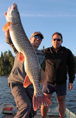 | ||
44 21 8lb pike winefred lake
Winefred Lake is a large lake in east-northern Alberta, Canada. It is located in southern Wood Buffalo, in a remote area between Cold Lake and Fort McMurray, and has a total area of 122.8 km2 (47.4 sq mi). The closest community is the hamlet of Conklin, at 70 km (43 mi).
Contents
- 44 21 8lb pike winefred lake
- Map of Winefred Lake Wood Buffalo AB Canada
- Hd gopro winefred lake 2015
- References
Map of Winefred Lake, Wood Buffalo, AB, Canada
Ecologically, the lake is set in boreal forest and muskeg environment, with frequent saline water degeneration of the groundwater flow. Winefred lake is drained through Winefred River (Alberta) into Christina River (Alberta) and then in Clearwater River to the Athabasca River.
Winefred Lake is known for fishing, having produced trophy size Northern Pike and Walleye. Hunting is also done around the lake, with moose and deer hunting, as well as trapping.
The 4.53 km2 (1.75 sq mi) Winefred Lake Indian Reserve of the Chipewyan Prairie First Nation is established on the northern shore of the lake.