
OS grid SD973141 Parent range Pennines | Elevation 413 m | |
 | ||
Similar Pennines, Blackstone Edge, Hail Storm Hill, Black Chew Head, Crompton Moor | ||
Windy Hill in the South Pennines within the Metropolitan Borough of Rochdale in Greater Manchester, England, rises to 389 metres above sea level.
Map of Windy Hill, Littleborough, UK
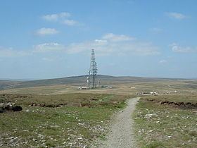
The hill is located west of the A672 road and south west of Junction 22 on the M62 motorway. Windy Hill cutting is up to 120 feet deep and the longest on the M62. A pedestrian footbridge, 320 feet long and 65 feet above the carriageways, carries the Pennine Way above Windy Hill cutting. Its parabolic arch and splayed legs are designed to withstand wind speeds up to 120 mph. Snow lies on Windy Hill for an average of 35 days annually and the area is prone to fog or low cloud. The boundary stone between Greater Manchester and West Yorkshire is in the cutting. The Longden End Brook rises between the hill and the motorway and the Piethorne Brook drains to reservoirs to the southwest. A radio transmitter is located to the east.