
Country United States County Riverside FIPS code 06-85894 Elevation 449 m Zip code 92596 Area code Area code 951 | Time zone PST (UTC-8) GNIS feature ID 1652814 Area 20.02 km² Population 2,534 (2010) | |
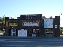 | ||
Winchester is a census-designated place (CDP) in Riverside County, California, USA. As of the 2010 census, the CDP had a total population of 2,534, up from 2,155 at the 2000 census.
Contents
- Map of Winchester CA USA
- Geography
- 2010
- 2000
- Suburbs surrounding Winchester
- Notable residents
- Politics
- References
Map of Winchester, CA, USA
Winchester was founded in 1886 in Pleasant Valley in what was then San Diego County. The town was named after the widow of Horace Winchester, Mrs. Amy Winchester.
Largely rural for most of its history, and home to agricultural businesses including the Winchester Cheese Company, Winchester experienced rapid growth during the housing construction boom in the early to mid-2000s. However, construction and growth slowed when the housing bubble burst in 2007, resulting in a housing market correction.
Geography
Winchester is located at 33°42′28″N 117°5′13″W (33.707871, -117.086861).
According to the United States Census Bureau, the CDP has a total area of 7.7 square miles (20 km2), all of it land.
It is next to the city of Hemet, California
2010
The 2010 United States Census reported that Winchester had a population of 2,534. The population density was 327.7 people per square mile (126.5/km²). The racial makeup of Winchester was 1,577 (62.2%) White, 38 (1.5%) African American, 17 (0.7%) Native American, 46 (1.8%) Asian, 2 (0.1%) Pacific Islander, 728 (28.7%) from other races, and 126 (5.0%) from two or more races. Hispanic or Latino of any race were 1,233 persons (48.7%).
The Census reported that 2,534 people (100% of the population) lived in households, 0 (0%) lived in non-institutionalized group quarters, and 0 (0%) were institutionalized.
There were 769 households, out of which 326 (42.4%) had children under the age of 18 living in them, 425 (55.3%) were opposite-sex married couples living together, 94 (12.2%) had a female householder with no husband present, 53 (6.9%) had a male householder with no wife present. There were 54 (7.0%) unmarried opposite-sex partnerships, and 6 (0.8%) same-sex married couples or partnerships. 149 households (19.4%) were made up of individuals and 71 (9.2%) had someone living alone who was 65 years of age or older. The average household size was 3.30. There were 572 families (74.4% of all households); the average family size was 3.78.
The population was spread out with 762 people (30.1%) under the age of 18, 218 people (8.6%) aged 18 to 24, 613 people (24.2%) aged 25 to 44, 649 people (25.6%) aged 45 to 64, and 292 people (11.5%) who were 65 years of age or older. The median age was 34.6 years. For every 100 females there were 102.6 males. For every 100 females age 18 and over, there were 104.4 males.
There were 850 housing units at an average density of 109.9 per square mile (42.4/km²), of which 491 (63.8%) were owner-occupied, and 278 (36.2%) were occupied by renters. The homeowner vacancy rate was 4.3%; the rental vacancy rate was 5.4%. 1,514 people (59.7% of the population) lived in owner-occupied housing units and 1,020 people (40.3%) lived in rental housing units.
2000
As of the census of 2000, there were 2,155 people, 741 households, and 532 families residing in the CDP. The population density was 304.1 people per square mile (117.4/km²). There were 819 housing units at an average density of 115.6 per square mile (44.6/km²). The racial makeup of the CDP was 78.1% White, 2.0% African American, 1.5% Native American, 0.4% Asian, 0.3% Pacific Islander, 14.3% from other races, and 3.5% from two or more races. Hispanic or Latino of any race were 31.4% of the population.
There were 741 households out of which 32.5% had children under the age of 18 living with them, 54.9% were married couples living together, 10.5% had a female householder with no husband present, and 28.2% were non-families. 22.0% of all households were made up of individuals and 9.4% had someone living alone who was 65 years of age or older. The average household size was 2.9 and the average family size was 3.4.
In the CDP, the population was spread out with 28.2% under the age of 18, 8.4% from 18 to 24, 26.1% from 25 to 44, 22.5% from 45 to 64, and 14.8% who were 65 years of age or older. The median age was 37 years. For every 100 females there were 99.9 males. For every 100 females age 18 and over, there were 98.0 males.
The median income for a household in the CDP was $33,472, and the median income for a family was $39,167. Males had a median income of $26,354 versus $28,021 for females. The per capita income for the CDP was $15,028. About 9.7% of families and 13.8% of the population were below the poverty line, including 9.8% of those under age 18 and 11.6% of those age 65 or over.
Suburbs surrounding Winchester
Notable residents
Politics
In the state legislature Winchester is located in the 37th Senate District, represented by Republican Bill Emmerson, and in the 65th Assembly District, represented by Republican Paul Cook.
In the United States House of Representatives, Winchester is in California's 42nd congressional district, represented by Republican Ken Calvert.