 | ||
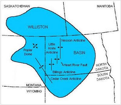
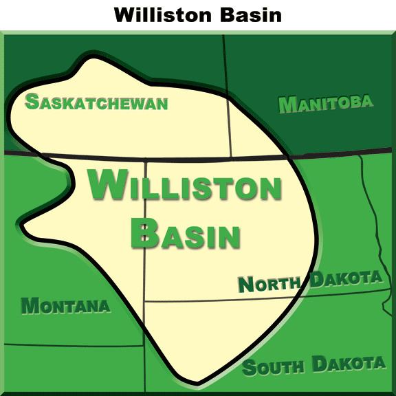
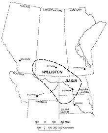
The Williston Basin is a large intracratonic sedimentary basin in eastern Montana, western North Dakota, South Dakota, and southern Saskatchewan, that is known for its rich deposits of petroleum and potash. The basin is a geologic structural basin but not a topographic depression; it is transected by the Missouri River. The oval-shaped depression extends approximately 475 miles (764 km) north-south and 300 miles (480 km) east-west.
Contents
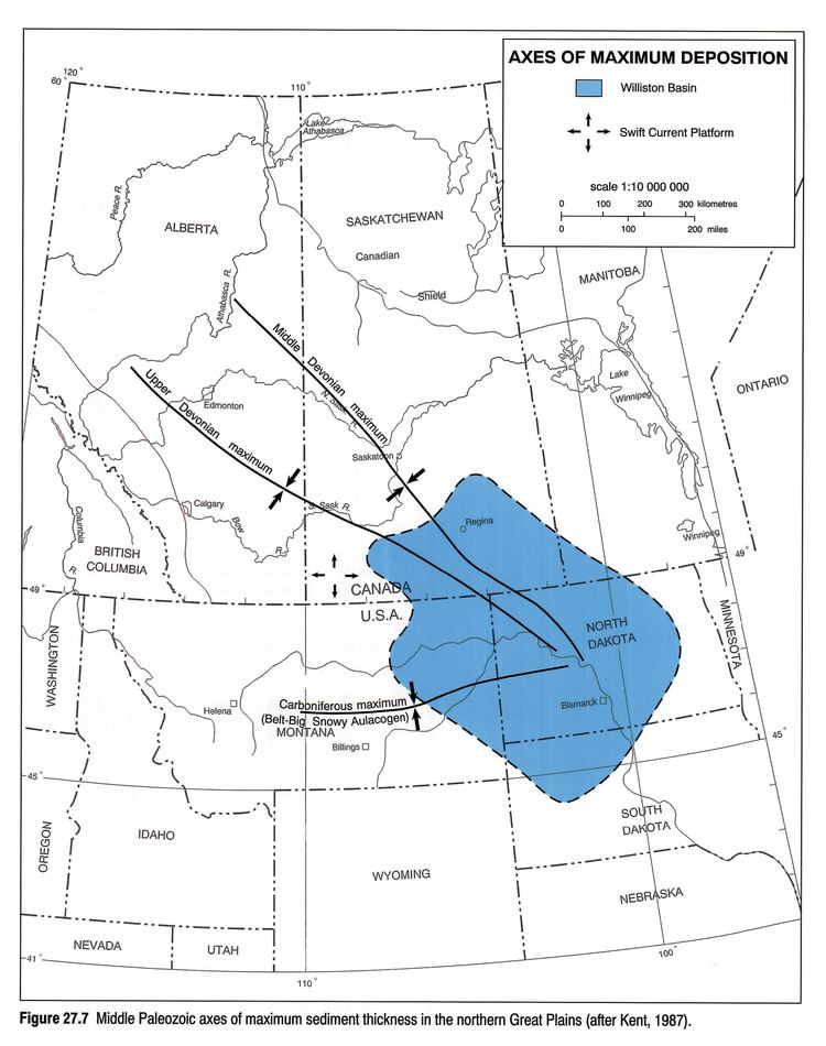
The Williston Basin lies above an ancient Precambrian geologic basement feature, the Trans-Hudson Orogenic Belt that developed in this area about 1.8-1.9 billion years ago, and that created a weak zone that later led to sagging to produce the basin. The Precambrian basement rocks in the center of the basin beneath the city of Williston, North Dakota lie about 16,000 feet (4,900 m) below the surface.
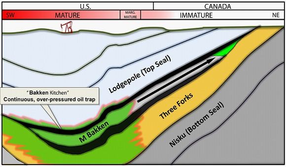
Deposition of sediments began in the Williston area during Cambrian time, but subsidence and basin filling were most intense during the Ordovician, Silurian, and Devonian Periods, when thick accumulations of limestone and dolomite, with lesser thicknesses of sandstones, siltsones, shales, and evaporites were laid down. Subsidence continued on a reduced scale into the Mississippian and was largely ended by Pennsylvanian time. Regional subsidence returned during the Mesozoic Era, although total sediment thicknesses were much less than during the Paleozoic. Near the end of the Cretaceous, tectonic activity during the Laramide Orogeny rejuvenated several basement structures in the Williston Basin to produce anticlines that serve as oil traps today.
Williston basin speedway stock feature 5 10 14
Impact craters
Several confirmed impact craters are located in Williston Basin such as Viewfield, Red Wing Creek, and Eagle Butte while the Dumas and Hartney craters are still unconfirmed.