
Mountain type Dachstein limestone | ||
 | ||
Elevation 2,578 m (AA) (8,458 ft) Prominence 2,578-2,464 m ↓ Mittagsscharte Parent range | ||
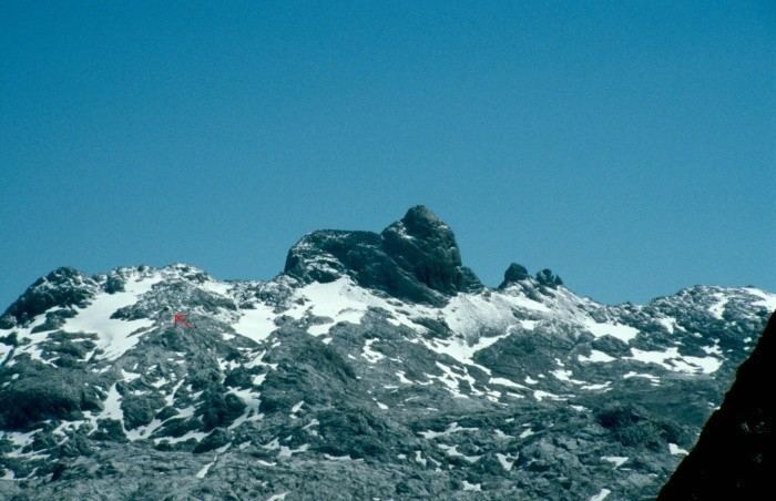
The Wildalmkirchl is a rocky peak, 2,578 m (AA), on the southern edge of the Steinernes Meer. It lies within the Austrian state of Salzburg, northeast of the village of Maria Alm and northwest of the Hochkönig massif.
Contents
Map of Wildkirchli, 9057 Schwende District, Switzerland
The first part of its name comes from the Wildalm ("wild alpine meadow"), a remote high valley located north of the Wildalmkirchl in the Austro-Bavarian border region in the Steinernes Meer range; the second part of its name is derived from the shape of the mountain which, from various standpoints resembles a church with its roof and tower. At a height of 2,457 m, northeast of the summit, is the Wildalmkirchl bothy or "wilderness hut" (Biwakschachtel) (open, 8 sleeping places).
The Wildalmkirchl, along with the Schottmalhorn, is the most difficult mountain to climb in the Steinernes Meer; all ascents involve climbing. The easiest route runs from the bothy to the northeastern of the "church" formation and up onto the "roof" (crumbling, I); the route then crosses the exposed Kirchdachgrat arête forming the ridge of the "roof", and scales the very exposed summit block which requires moderately difficult climbing at grade (II); in all this takes about 40 minutes of climbing time from the bothy.