
Demonym(s) Wijchenaar Area code 024, 0486, 0487 | Elevation 9 m (30 ft) Time zone CET (UTC+1) Area 69.56 km² Local time Sunday 11:47 PM | |
 | ||
Postcode 6600–6606, 6613–6617, 6634 Weather 10°C, Wind N at 6 km/h, 82% Humidity | ||
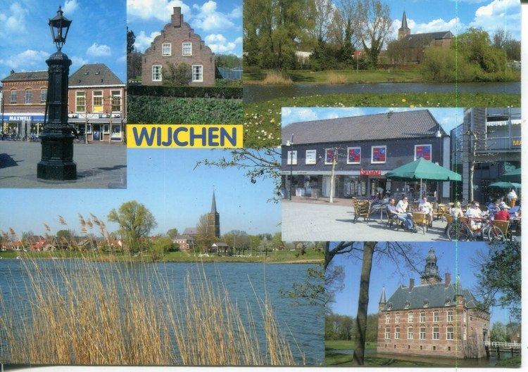
Wijchen ( [ˈʋixə(n)]) is a municipality and a town in the province of Gelderland, in the eastern part of the Netherlands.
Contents
- Map of Wijchen Netherlands
- Population centres
- Neighbourhoods
- Wijchen Castle town hall
- Notable residents
- References
Map of Wijchen, Netherlands
Population centres
Number of residents per population centre per 12 December 2009:
Source: Statistics Netherlands
The population centre Woezik (3,820 residents on 1 January 2005) and the township Laak are statistically included in Wijchen.
Neighbourhoods
Neighbourhoods in Wijchen include:
Streets in most neighbourhoods are numbered instead of named. This is not common practice in the Netherlands, therefore the street numbers are included in the house numbering. E.g. someone living in Abersland, 11th street, house #05 will usually use Abersland 1105 in his address.
Wijchen Castle (town hall)
Parts of Wijchen Castle (Kasteel Wijchen in Dutch) date from the 14th century, but it took its current Mannerist form in the years 1609–1629. It is surrounded by a moat and used to serve as the town hall. Currently, the town hall is on the other side of the road, while the castle is only used for important meetings.