Admin. region Stuttgart Elevation 592 m (1,942 ft) Local time Sunday 10:35 PM | Time zone CET/CEST (UTC+1/+2) Population 2,234 (31 Dec 2008) | |
 | ||
Weather 11°C, Wind NW at 11 km/h, 80% Humidity Points of interest Filsursprung, Schloss Wiesensteig, Bläsiberg Skilifte Wiesensteig | ||
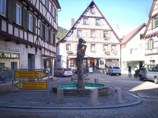
Wiesensteig is a town in the district of Göppingen in Baden-Württemberg in southern Germany. It is located on the river Fils, 16 km south of Göppingen.
Contents
- Map of 73349 Wiesensteig Germany
- Geographical location
- Constituent communities
- Neighbouring communities
- History
- Population development
- Council and mayor
- Traffic
- Education
- Buildings
- Natural Monuments
- Ski
- Other Sports
- Sons and daughters of the town
- Literature
- References
Map of 73349 Wiesensteig, Germany
Geographical location
Wiesensteig is located in the upper Fils valley in 575–750 meters altitude in Göppingen (district). At the edge of the town passes Bundesautobahn 8 to Ulm.
Constituent communities
To Wiesensteig belongs the town of Wiesensteig, the courtyards Bläsiberg, Eckhöfe, Heidental, Reußenstein and Ziegelhof and the houses Lämmerbuckel, Papiermühle and the dialed towns Michelnbuch and Schafhaus
Neighbouring communities
Adjacent municipalities are Gruibingen in the north, Mühlhausen im Täle in the northeast, Drackenstein in the east, Hohenstadt in the south east, Westerheim (Alb-Donau-Kreis) in the south, Römerstein (Reutlingen (district)) in the southwest and Lenningen in the west and Neidlingen (both Esslingen (district)) in the northwest.
History
Wiesensteig was first mentioned in 861 in a document, as there was founded a Benedictine monastery.
The town has the town privileges since 1356. It was then under the House of Helfenstein. Since 1512 the rule Wiesensteig was assigned to the Swabian Circle within the Holy Roman Empire.
Count Ulrich XVII of Helfenstein (1524-1570) and his brother Sebastian († 1564) introduced in 1555 the Lutheran confession in Wiesensteig. 1562/63 in the rule Wiesensteig a great witch-hunt took place in which at least 63 women and men were executed.
After the extinction of the House of Helfenstein in 1627 the Reich County Wiesensteig fell about two-thirds in 1642 by purchase to Altbayern and one third to the House of Fürstenberg (Swabia). Through a land swap the town came in 1806 to the Kingdom of Württemberg and became the seat of Oberamt Wiesensteig.
Population development
The number of inhabitants between 1837 and 2010.
Council and mayor
The local council of Wiesensteig has since the local elections in Baden-Württemberg May 25, 2014 12 members, including two women.
The mayor Gebhard Tritschler (independent) was elected in 2010.
Traffic
About the Landesstraße 1200 Wiesensteig has connection to the Bundesstraße B 466 and to the Bundesautobahn A 8. Wiesensteig is located on the Swabian Jura Route.
From 1903 to 1968 Wiesensteig was connected by the "Tälesbahn" (Geislingen-Wiesensteig) to the national rail network.
Education
With the Franz Xaver Messerschmidt School Wiesensteig has a primary and a high school with Werkrealschule.
Buildings
Natural Monuments
Ski
Wiesensteig has with the ski area Bläsiberg the largest ski resort in the Swabian Jura. It includes three tows and about 5 km slopes with different levels of difficulty.
Other Sports
The TSV Obere Fils was founded on June 24, 1972 by the merger of the two clubs TSV Wiesensteig and TSV Mühlhausen.
