
Population 112 (2006 census) Postcode(s) 6473 Elevation 414 m Postal code 6473 | Established 1933 Founded 1933 Local time Monday 12:37 AM | |
 | ||
Weather 18°C, Wind NE at 16 km/h, 42% Humidity | ||
Wialki is a small town in the eastern Wheatbelt region of Western Australia. It is situated between Beacon and Bonnie Rock.
Map of Wialki WA 6473, Australia
The town was formed as a result of an extension to the railway that was planned to pass through the area in 1929. The district surveyor suggested the station should be named Datjoin but the Railway department chose the name Wialki after the Aboriginal name of a nearby soak. The station was named in 1930 and the townsite was gazetted in 1933. The meaning of the name is not known.
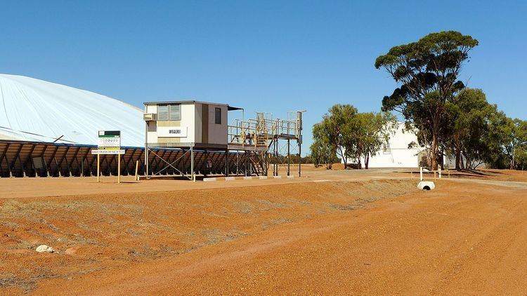
The surrounding areas produce wheat and other cereal crops. A second bulk wheat bin was constructed in town in 1940 just as the first bulk bin was filled. The town is a receival site for Cooperative Bulk Handling.
References
Wialki, Western Australia Wikipedia(Text) CC BY-SA