
Population 5,434 (2011 Census) Civil parish Whittle-le-Woods Local time Sunday 2:07 PM | OS grid reference SD577218 Sovereign state United Kingdom | |
 | ||
Weather 13°C, Wind W at 14 km/h, 62% Humidity | ||
Sunset over whittle le woods
Whittle-le-Woods is a village and civil parish of the Borough of Chorley in Lancashire, England. The population of the civil parish at the 2011 census was 5,434.
Contents
Map of Whittle-le-Woods, UK
Whittle-le-Woods lies on the A6, about three miles north of the town of Chorley, and to the south of the city of Preston. It is divided into two areas, the older part on the old coach road running through Waterhouse Green to Brindle and the more modern part on the A6 road where the church of St John is situated. In the north east is St Chad's RC Church and off the A6 is Shaw Hill Hotel, Golf and Country Club centred on the Shaw Hill Georgian mansion.
It has experienced much residential development during the last twenty years. This has established the village as a popular commuter area, as it lies close to Preston and between the M6 and M61 motorways. The name of this village comes from 'a white hill' with the 'le-woods' part added at a later date with a subsequent meaning 'A white hill in the woods'.
The Church of Jesus Christ of Latter-day Saints (or Preston Temple) is a notable landmark in Whittle-le-Woods, both for its striking appearance and for the fact it is the largest Mormon temple in the British Isles.
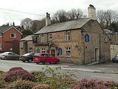
Just over a mile to the east of the M61 is the hamlet of Whittle Springs. The Leeds and Liverpool Canal passes a junction in the hamlet, where the south end of the Lancaster Canal formerly continued north to Walton Summit. This is also the start of a flight of locks called Johnson's Hillock Locks, which continue via Heapey and Wheelton in the direction of Blackburn. Whittle is also known for fishing places, such as Lower Mill off Town Lane and Top Lock. Whittle has many public houses, and it is close to the Shaw Hill golf course on the A6.
History
Whittle was on the map due to its Sandstone quarries. Mainly 2 large quarries on Hill Top Lane. Whittle Hill Quarry is one of the deepest quarries in the North West. These were fed by the canal which took stone that had been excavated to Walton Summit and Wigan.
Lancaster Canal Southern End
Whittle-le-Woods was home to the Walton Summit Branch. A small three mile stretch of canal, which was supposed to be part of the complete Lancaster Canal between Kendal and Westhoughton, near Wigan. Although it was never completed the two parts (i.e. North Section and South Section) were linked with a 'temporary' tram road. Ironically, the tram road survived, and the canal did not. Originally, the canal passed through the Whittle Hills, East of the village itself, via a long tunnel, engineered by John Rennie.
It collapsed in the 1830s, and was later split into two tunnels, East and West (these are of less interest). Between though as a deep cutting which famously in the 1960s, an engineer from the British Rail and Waterways museum commented "have no problems matching the Shropshire Union canal". The canal was last used in the 1930s, although teenagers navigated the canal days before it was to be destroyed by the M61. Most of the canals bridges and tunnels remain, although they are in a poor condition.