
Area 228 ha Added to NRHP 25 October 1989 | Phone +1 507-932-3007 | |
 | ||
Address 19041 MN-74, Altura, MN 55910, USA Hours Open today · 9AM–4PMSunday9AM–4PMMonday9AM–4PMTuesday9AM–4PMWednesday9AM–4PMThursday9AM–4PMFriday9AM–4PMSaturday9AM–4PMSuggest an edit | ||
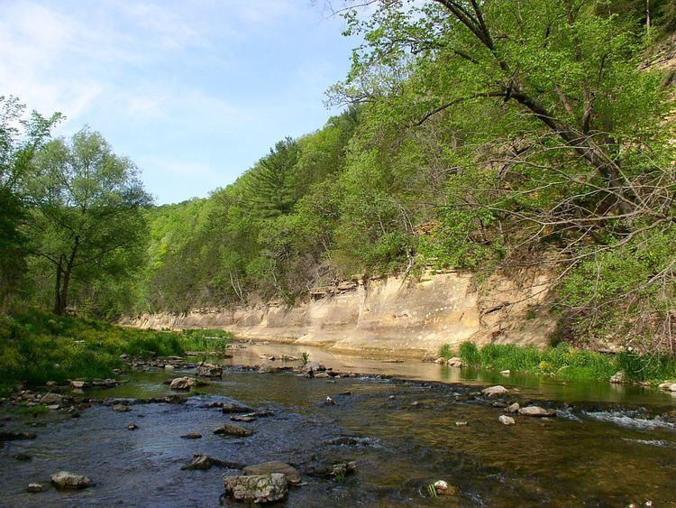
Whitewater State Park is a state park of Minnesota, United States, preserving a stretch of the Whitewater River surrounded by rocky bluffs. It is located in Winona County in the southeastern blufflands area of the state. The 2,700-acre (11 km2) park features scenic overlooks and trout fishing in the spring-fed Whitewater River and Trout Run Creek. It has about 300,000 visitors annually, and is located 7 miles (11 km) north of St. Charles on Minnesota State Highway 74, which runs through the park.
Contents
- Whitewater state park minnesota
- Historic structuresEdit
- LandformsEdit
- LifeformsEdit
- 2007 floodEdit
- References
Whitewater state park minnesota
Historic structuresEdit
The park's 1930s facilities are listed on the National Register of Historic Places as the Whitewater State Park CCC/WPA/Rustic Style Historic Resources. The 536-acre (217 ha) historic district includes 29 contributing properties. The district was listed for having state-level significance in the themes of architecture, entertainment/recreation, landscape architecture, and politics/government. It was nominated for its examples of New Deal federal work relief, diverse National Park Service rustic design, and landscape architecture on a challenging site.
LandformsEdit
The park's bedrock is lower Paleozoic sedimentary rocks, with limestone and dolomite especially prevalent near the surface. It is highly dissected, and the Whitewater River has cut deep valleys into the bedrock. It is an area of karst topography.
LifeformsEdit
The park is located where the Rochester Plateau Subsection and the Blufflands Subsection meet, both of which are part of the Paleozoic Plateau section of the Eastern Broadleaf Forest Province.
2007 floodEdit
The August 18 and 19, 2007 Midwest flooding caused extensive damage to the park. The park is in the Driftless Area, where soils are thin and less able to retain water; they lie atop porous rock into and through which surface waters can rapidly drain into the water table. The steep hills and bluffs and deep coulees give steep gradients to the drainage and makes streams highly erosive. As the rains far exceeded the absorption rate of the soils, flash floods rapidly overflowed the river and spread across the valley floors.
About 500 campers were staying in the park at the time. Three bridges were destroyed, and campgrounds, bathhouses, a group dining hall, and water and sewer systems suffered extensive damage. Damage was in excess of four million dollars, and the park was closed to the public on August 20, 2007, and remained closed the balance of the year. On March 1, 2008 it partially reopened, but many of its amenities still had unrepaired damage.