
- elevation 1,184 ft (361 m) | - elevation 361 ft (110 m) | |
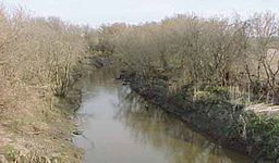 | ||
- location Near Augusta, Kansas, United States | ||
The Whitewater River is a 62-mile-long (100 km) tributary of the Walnut River in southern Kansas in the United States. Via the Walnut and Arkansas Rivers, it is part of the watershed of the Mississippi River.
Contents
Map of Whitewater River, Kansas, USA
According to the Geographic Names Information System, the stream has also been known as Whitewater Creek.
CourseEdit
The Whitewater River rises in southern Marion County (southeast of Peabody) and flows southwardly into Butler County, past the towns of Potwin and Towanda, then joins the Walnut River at Augusta.
In Butler County, the river collects the West Branch Whitewater River, which rises in Harvey County and flows southeastwardly past Whitewater; and the East Branch Whitewater River, which rises near Burns in Marion County and flows southwestwardly.