
Country Canada Incorporated 2000 Postal Code P0A Mayor Chris Armstrong | Time zone EST (UTC-5) Website www.whitestone.ca Area code 705 | |
 | ||
Whitestone is a township in the Canadian province of Ontario, as well as the name of a community within the township.
Contents
Map of Whitestone, ON, Canada
The township, located in the Parry Sound District, had a population of 916 in the 2011 Canadian census.
History
In 2000, the Municipality of Whitestone was formed out of Unorganized Centre Parry Sound District and incorporated by the Parry Sound District Restructuring Commission. The new municipality includes the geographic townships of East Burpee, Burton, McKenzie, Ferrie, Hagerman, and part of Croft, as well as the communities of Ardbeg, Dunchurch, Maple Island, and the village of Whitestone.
A popular attraction was once the Ardbeg fire tower, which was one of the last remaining manned towers in Southern Ontario until the early 1970s when aerial forest fire detection took over. It stood on a small hill where the road meets the railway.
Communities
The township comprises the communities of Ardbeg, Boakview, Bolger, Burton, Dunchurch, Fairholme, Lorimer Lake, Maple Island, South Magnetawan, Sunny Slope, Wahwashkesh, and Whitestone.
Geography
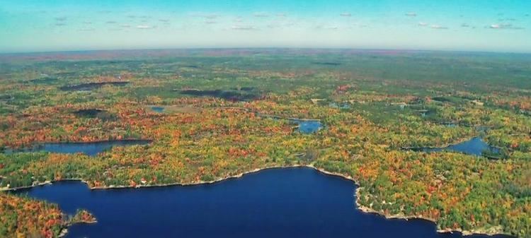
The municipality's vegetation is dominated by white pine trees, and the area is dotted with many lakes, including Wahwashkesh Lake, Shawanaga Lake, Whitestone Lake, and Lorimer Lake. The three major rivers are Magnetawan River, Shawanaga River, and Naiscoot River, all flowing west into Georgian Bay.
Demographics
Population trend:
Private dwellings occupied by usual residents: 416 (total dwellings: 1093)
Mother tongue: