
- elevation 1,339 ft (408 m) - elevation 829 ft (253 m) Discharge 9.713 m³/s Secondary source Dunkard Fork | - elevation 927 ft (283 m) Length 40 km Basin area 777 km² Source Enlow Fork | |
 | ||
- location northeastern Marshall County near Majorsville, West Virginia | ||
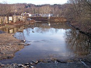
Wheeling Creek is a tributary of the Ohio River, 25 miles (40 km) long, in the Northern Panhandle of West Virginia in the United States, with a watershed extending into southwestern Pennsylvania. Via the Ohio River, it is part of the watershed of the Mississippi River, draining an area of approximately 300 square miles (780 km2) on the unglaciated portion of the Allegheny Plateau. It flows into the Ohio River in downtown Wheeling, just downstream of Ohio's Wheeling Creek on the opposite bank. According to the Geographic Names Information System, it has also been known as Big Wheeling Creek.
Contents
Map of Wheeling Creek, United States
GeographyEdit
Wheeling Creek is formed in northeastern Marshall County, West Virginia, by the confluence of streams known as the Enlow Fork and the Dunkard Fork:
From the confluence of the Dunkard and Enlow forks, Wheeling Creek flows northwestwardly into the city of Wheeling in Ohio County. In the Elm Grove neighborhood of Wheeling, it collects Little Wheeling Creek, which rises in Ohio County just west of the Pennsylvania state line and flows southwestwardly through the communities of Valley Grove and Triadelphia. In Triadelphia, Little Wheeling Creek collects Middle Wheeling Creek, which rises in West Finley Township in Greene County, Pennsylvania, and flows generally westwardly into southeastern Ohio County.
The National Road (U.S. Route 40) parallels Little Wheeling Creek through eastern Ohio County, and follows Wheeling Creek for part of its route through the city of Wheeling; the creek is also paralleled for five miles (8 km) in Wheeling by a rail trail as part of the Wheeling Heritage Trail network.
According to the West Virginia Department of Environmental Protection, of the 141 square miles (370 km2) drained by Wheeling Creek in West Virginia, approximately 67% is forested; approximately 27% is used for agriculture; and approximately 5% is urban.
Flow rateEdit
The United States Geological Survey operates a stream gauge on the creek in the Elm Grove neighborhood of Wheeling, downstream of the mouth of Little Wheeling Creek and 7.8 miles (12.6 km) upstream of the creek's mouth. Between 1941 and 2005, the annual mean flow of the creek at the gauge was 343 cubic feet per second (9.7 m³/s). The creek's highest flow during the period was estimated at 22,300 ft³/s (632 m³/s) on September 17, 2004. The lowest recorded flow was 0.1 ft³/s (0 m³/s) on October 7, 1963, and on two days in September 1964.
FishingEdit
Wheeling Creek is a popular fishing destination to those close to it. There are many entry points located alongside the Wheeling Heritage Trail System. There are a variety of fish species including muskellunge, smallmouth bass, sunfish, hognose suckers, various species of catfish, and bluegill. Wheeling Creek is also regularly stocked with rainbow trout and brown trout.