
Founded 1917 | Congressional district At-large Area 3,698 km² Population 2,134 (2013) Unemployment rate 4.4% (Apr 2015) | |
 | ||
Website www.harlowtonchamber.com Rivers Musselshell River, Simmons Creek, Agnes Creek | ||
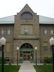
Wheatland County is a county located in the U.S. state of Montana. As of the 2010 census, the population was 2,168. Its county seat is Harlowton.
Contents
- Map of Wheatland County MT USA
- Geography
- Major highways
- Adjacent counties
- National protected area
- 2000 census
- 2010 census
- Cities
- Census designated place
- Unincorporated community
- References
Map of Wheatland County, MT, USA
Geography
According to the U.S. Census Bureau, the county has a total area of 1,428 square miles (3,700 km2), of which 1,423 square miles (3,690 km2) is land and 5.0 square miles (13 km2) (0.4%) is water.
Major highways
Adjacent counties
National protected area
2000 census
As of the census of 2000, there were 2,259 people, 853 households, and 540 families residing in the county. The population density was 2 people per square mile (1/km²). There were 1,154 housing units at an average density of 1 per square mile (0/km²). The racial makeup of the county was 96.99% White, 0.13% Black or African American, 0.58% Native American, 0.18% Asian, 0.22% Pacific Islander, 0.27% from other races, and 1.64% from two or more races. 1.11% of the population were Hispanic or Latino of any race. 38.4% were of German, 11.6% Norwegian, 7.5% English, 7.4% Irish and 6.5% American ancestry. 87.4% spoke English and 12.2% German as their first language.
There were 853 households out of which 25.80% had children under the age of 18 living with them, 53.80% were married couples living together, 4.90% had a female householder with no husband present, and 36.60% were non-families. 34.50% of all households were made up of individuals and 16.40% had someone living alone who was 65 years of age or older. The average household size was 2.24 and the average family size was 2.86.
In the county, the population was spread out with 26.80% under the age of 18, 6.40% from 18 to 24, 22.00% from 25 to 44, 25.50% from 45 to 64, and 19.30% who were 65 years of age or older. The median age was 41 years. For every 100 females there were 98.00 males. For every 100 females age 18 and over, there were 99.20 males.
The median income for a household in the county was $24,492, and the median income for a family was $32,500. Males had a median income of $14,185 versus $15,000 for females. The per capita income for the county was $11,954. About 11.10% of families and 20.40% of the population were below the poverty line, including 16.00% of those under age 18 and 15.50% of those age 65 or over.
2010 census
As of the 2010 United States Census, there were 2,168 people, 887 households, and 538 families residing in the county. The population density was 1.5 inhabitants per square mile (0.58/km2). There were 1,197 housing units at an average density of 0.8 per square mile (0.31/km2). The racial makeup of the county was 95.8% white, 0.6% Asian, 0.5% American Indian, 0.3% black or African American, 0.4% from other races, and 2.4% from two or more races. Those of Hispanic or Latino origin made up 1.5% of the population. In terms of ancestry, 35.2% were American, 22.7% were German, 14.1% were English, 11.5% were Irish, and 6.6% were Norwegian.
Of the 887 households, 23.7% had children under the age of 18 living with them, 50.8% were married couples living together, 6.4% had a female householder with no husband present, 39.3% were non-families, and 35.4% of all households were made up of individuals. The average household size was 2.28 and the average family size was 2.99. The median age was 44.9 years.
The median income for a household in the county was $30,321 and the median income for a family was $41,161. Males had a median income of $30,769 versus $17,083 for females. The per capita income for the county was $18,474. About 5.1% of families and 11.5% of the population were below the poverty line, including 8.8% of those under age 18 and 27.6% of those age 65 or over.