
Country Austria Postal code 6363 Elevation 783 m Population 3,564 (1 Apr 2009) | Time zone CET (UTC+1) Area code 05334 Area 95.52 km² Local time Saturday 8:00 AM | |
 | ||
Weather 6°C, Wind S at 5 km/h, 75% Humidity | ||
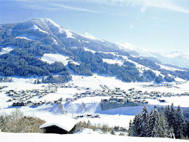
Westendorf is a municipality in the Kitzbühel district in the Austrian state of Tyrol located 13.7 km west of Kitzbühel and 12 km southeast of Wörgl in the Brixental valley. The community is a popular ski resort as well as a popular location for Summer tourism especially for excursions and walking-tours. Westendorf was mentioned for the first time in documents in 1234. It has 21 village parts.
Contents
Map of 6363 Westendorf, Austria
Geography
Westendorf lies on a sunny terrace of the Brixental valley, at the foot of the Choralpe. The parish consists of a clustered village (Haufendorf) and other hamlets and farmsteads in the surrounding area, as well as an industrial estate. To the south the Windautal, a popular recreation area, branches off.
A large part of the parish is wooded or used for agricultural purposes.
Rivers: The Brixentaler Ache and the Windauer Ache flow through the parish.
Mountains: Important mountains are the Hohe Salve (1,828m), the Steinbergstein (2,215m), the Kröndlhorn (2,444m) and the Brechhorn (2,032m).