
OS grid reference SP725585 Sovereign state United Kingdom | Civil parish West Hunsbury Dialling code 01604 | |
 | ||
Population 4,751 (United Kingdom ONS 2013) Data for West Hunsbury ward, Northampton Borough Council"/> | ||
West Hunsbury Parish is a large housing estate in the south of the town of Northampton, 2 miles (3 km) from the town centre, 0 miles (0 km) from the M1 motorway, junction 15A and 2 miles (3 km) from junction 15. The motorway can be seen and heard as most of the area is elevated and the wind's prevailing direction is westerly. It is part of the Hunsbury residential area, which also constitutes East Hunsbury east of Towcester Road. Shelfleys is the original name for the area and still appears on signs and maps. The area is part of the Borough of Northampton. The area was developed in the 1970s, 1980s, 1990s and 2000s as part of the expansion of Northampton.
Contents
Demographics
The 2001 census shows a population of 7,468 of which 3,727 were male and 3,741 female, in 3,005 households. However, note that this data applies to the West Hunsbury ward of Northampton Borough Council which includes areas outside of West Hunsbury proper, as the areas are not parished – see the notes on Governance below.
Community
There is a modern church, St Benedicts, Church of England, and shops including a small supermarket, estate agents, post office, pharmacy, optician. A pub, "The Ironstone", in Hunsbury Hill Road closed in 2012. The same site also has a health centre. In the car park of Hunsbury Hill Country Park there is now a small café called "The Drover's Return" named after the ancient Drover's Pathway which leads through the park.
Opposite the shop area is an area of sheltered housing grouped around a small community centre used for social events and meetings.
The area shares many facilities with East Hunsbury especially at the junction of the old Towcester road and Mereway ring road including a large Tesco 'Extra' supermarket open 24 hours, except Sunday, 10.00–16.00, petrol station, Subway restaurant, estate agent, a licensed Indian restaurant, take-away and bar, and dry cleaners. There is also the Danes Camp Leisure centre and swimming pool. Collingtree Park Golf Course is in Windingbrooke Lane and accessible from Rowtree Road in East Hunsbury.
The Hunsbury Hill Centre is a collection of old farm buildings built about 1770 overlooking the River Nene valley to the north. The main farmhouse is a grade II listed building. The centre is for community use and has three separate function rooms surrounding an octagonal courtyard which can host a variety of events. The main hall seats up to 120 and there is ample free parking in the pleasant and peaceful grounds. The centre is owned by Northamptonshire ACRE, "Action with Communities in Rural England" an independent charitable organisation, working with rural communities in Northamptonshire. Income generated from the centre goes to support the charity's running costs.
Parks
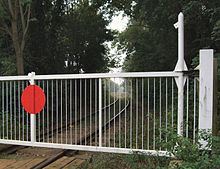
The site of an Iron Age hill fort, dating from ca. 400BC, the area is now part of Hunsbury Hill Country Park. The area around was also extensively mined for ironstone between 1880 and 1921 and a section of the railway used to transport the material remains in use for demonstration purposes together with a museum. Another park at the bottom of the hill near the motorway separates the housing development from The Counties Crematorium.
Schools
There is a primary school in the area: Hunsbury Park Primary School. The area is in the catchment of Abbeyfield School located on the north side of Mere Way dual carriageway which is also a business and enterprise college. The school was previously Mereway Upper School and, prior to 2008, Mereway Performing Arts College.
Several village schools south of the town are popular including the primary schools at Milton Malsor, Gayton, Rothersthorpe, Blisworth and Collingtree. Many children of secondary age use Campion School in Bugbrooke and Caroline Chisholm School in nearby Wootton.
Governance
After a Community Governance Review in 2012 a new civil parish council was formed on 1 April 2013 with the first elections to the new council on 2 May 2013.
West Hunsbury originally spanned two parishes: Hardingstone, north of Green Lane and Wootton to the south and east, but was de-parished in a boundary review during the 1980s. From 1999 to the 2011 borough elections West Hunsbury form part of a larger borough ward also called West Hunsbury which elected two borough councillors both Liberal Democrat. However, note that the ward also includes housing estates outside of West Hunsbury proper, namely Camp Hill, Hunsbury Meadows, Upton Parish (includes St Crispins Estate and other areas south of Berrywood Road such as Camelot Way ) and a small part of East Hunsbury. From 2011, when boundary changes made West Hunsbury ( and Camp Hill ) into its own Borough Ward of Northampton Borough Council electing one member, most of the remaining area moving to the two-member Upton ward. In 2013, West Hunsbury Parish Council was formed with 8 elected members and covered the same area as the borough ward.
West Hunsbury was part of the Northampton South constituency, Conservative. From the 2010 general election it was transferred to the new seat of South Northamptonshire, also considered a 'safe' Conservative seat.