
Topo map Lookout Mountain Last eruption 5750 BCE (?) | Elevation 1,329 m Volcanic arc Cascade Volcanoes | |
 | ||
Similar Indian Heaven, Blue Lake Crater, Cinnamon Butte, Four Craters Lava Field, Brushy Butte | ||
West Crater is a small andesitic lava dome with associated lava flows in southern Washington, United States.
Map of West Crater, Washington 98610, USA
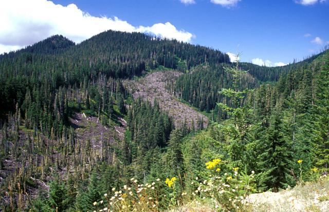
West Crater is a little-known Quaternary volcanic field in the southern Cascades of Washington between Mount St. Helens and Mount Hood. West Crater itself, seen here from the NE, is an andesitic dome with two small lava flows, one of which forms the bare area at the right center. The 290-m-high dome was formed about 8060 years ago on the floor of a cirque carved into older Tertiary volcanic rocks. The West Crater volcanic field consists of a series of small shield volcanoes and cinder cones along a NW-SE zone.
References
West Crater Wikipedia(Text) CC BY-SA