
Country United States Elevation 317 m Population 1,272 (2010) | GNIS feature ID 454045 Area 38.69 km² Local time Sunday 12:54 PM | |
 | ||
Weather 21°C, Wind S at 26 km/h, 32% Humidity | ||
Webster Township is one of fifteen townships in Wayne County, Indiana, United States. As of the 2010 census, its population was 1,272 and it contained 552 housing units.
Contents
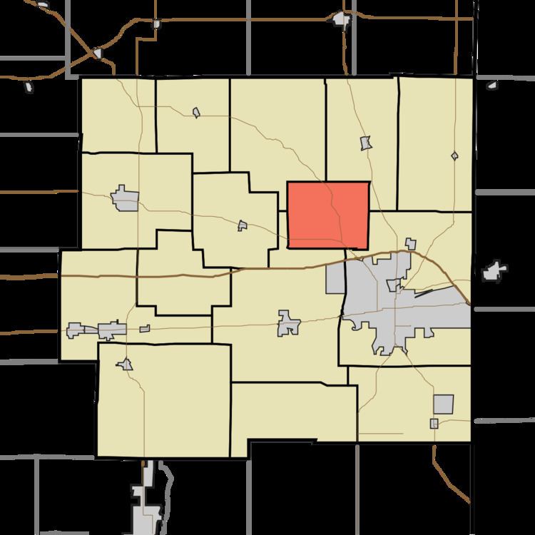
- Map of Webster Township IN USA
- History
- Geography
- Unincorporated towns
- Adjacent townships
- Cemeteries
- Major highways
- References
Map of Webster Township, IN, USA
History
Webster Township was organized in 1870.
Geography
According to the 2010 census, the township has a total area of 14.94 square miles (38.7 km2), of which 14.89 square miles (38.6 km2) (or 99.67%) is land and 0.05 square miles (0.13 km2) (or 0.33%) is water. The streams of Dover Run, High Brook, Long Creek, Nail Creek, Quill Creek, Single Creek, Spike Brook, Tie Run, Web Branch, Web Creek and Webster Creek run through this township.
Unincorporated towns
(This list is based on USGS data and may include former settlements.)
Adjacent townships
Cemeteries
The township contains one cemetery, Dover.
Major highways
References
Webster Township, Wayne County, Indiana Wikipedia(Text) CC BY-SA