
OS grid reference SJ616742 Sovereign state United Kingdom Dialling code 01606 | Civil parish Weaverham Local time Sunday 4:10 PM | |
 | ||
Unitary authority Weather 17°C, Wind W at 27 km/h, 64% Humidity | ||
Chemtrail photos skys over weaverham northwich cheshire 1st october 2014
Weaverham is a village and civil parish in the Borough of Cheshire West and Chester and the ceremonial county of Cheshire in England. Just off the A49, it is just to the west of Northwich and south of the River Weaver, and has a population of 6,589, decreasing to 6,391 at the 2011 Census.
Contents
- Chemtrail photos skys over weaverham northwich cheshire 1st october 2014
- Map of Weaverham Northwich UK
- 1 10 2014 lovely patterns of chemtrails over weaverham northwich cheshire 1st october 2014
- Governance
- References
Map of Weaverham, Northwich, UK
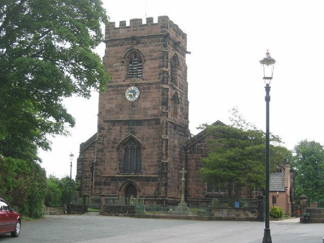
Weaverham is also home to the Anglican church of St Mary's, the Roman Catholic church of St Bede's and the Methodist church of All Saints. From September 2011, the Storehouse Church also meets weekly in Weaverham.
The schools in Weaverham include the following: one high school: Weaverham High School; three primary schools: St. Bede's Roman Catholic Primary School, Weaverham Forest School and University Primary Academy Weaverham, formerly Wallerscote Community Primary School. There is also a special needs school, The Russett School.
Weaverham is adjacent to Owley Wood, part of the Mersey Forest. The wood extends for over five hectares along the River Weaver valley and is named after the tawny owls which inhabit the area.
1 10 2014 lovely patterns of chemtrails over weaverham northwich cheshire 1st october 2014
Governance
An electoral ward in the name of Weaver and Cuddington exists. This covers both parishes and the surrounding area. The total population of the ward at the 2011 census was 12,779.