
OS grid SO215300 Prominence 622 m | Elevation 811 m Topo map OS Landranger 161 Translation small moor (Welsh) | |
 | ||
Listing Marilyn, Hewitt, Nuttall Similar | ||
Black mountains waun fach circular walk
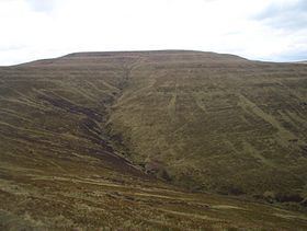
Waun Fach is the highest mountain at 2661 feet in the Black Mountains in south-eastern Wales. It is one of the three Marilyns over 600m that make up the range, the others being Black Mountain and Mynydd Troed. To the north Rhos Fawr and the Radnor Forest can be seen. After Pen y Fan, it is the second highest mountain in mainland Britain south of Snowdonia.
Contents
- Black mountains waun fach circular walk
- Map of Pen Trumau Crickhowell UK
- Black mountains wales real waun fach in the brecon beacons
- Access
- References
Map of Pen Trumau, Crickhowell, UK
Black mountains wales real waun fach in the brecon beacons
Access
It is situated at the head of the Grwyne Fechan valley, above and to the west of the Grwyne Fawr reservoir [1]. It has an undistinguished (and almost indistinguishable [2]) rounded summit [3]. The nearby tops on the ridge, Pen Trumau and Pen y Gadair Fawr [4], although lower, are very much more recognisable.
References
Waun Fach Wikipedia(Text) CC BY-SA