
 | ||
The Watertown Branch Railroad was a branch loop of the Fitchburg Railroad that was meant to serve the town of Watertown and the City of Waltham, Middlesex County, Massachusetts, as an independent short line railroad; it also serviced the Watertown Arsenal. The line has been formally abandoned and portions are being converted into a rail trail, the Watertown-Cambridge Greenway. A section from School Street to Arlington Street in Watertown has been completed. A small portion in Waltham has been converted into a park called Chemistry Station Park after the railroad station once located there. An extension to Fresh Pond Reservation in Cambridge is in design.
Contents
History
The railroad was chartered in 1846 and a second company, the Waltham and Watertown Railroad, was chartered to extend the line to the neighborhood just southeast of downtown Waltham, Massachusetts. In order to keep it out of the hands of its rivals, the Fitchburg took control of both companies before any track was laid and merged them into the Watertown Branch.
Construction began from West Cambridge in 1847 and was completed to Bemis two years later. By 1851 it reached the Fitchburg's main line at the downtown Waltham station and the branch served as the main passenger line between Boston and Waltham. It was one of the few branch lines to be double tracked, as the line saw quite heavy traffic, especially in the 1880s and 1890s. But things went downhill once the Boston and Maine Railroad took over the Fitchburg in 1900.
Passenger service on the line ended in 1938 and the second track was removed by early 1940. The middle section of the line from the Waltham/Watertown line through Watertown Square to East Watertown was abandoned in 1960. This split the branch line in two, but traffic continued on both sides through the remainder of the 20th century. In 1991, about a half mile of track was abandoned on the west side of the line at Bemis, and the remainder of the line back to Waltham was abandoned in 2000.
On October 5, 2011, the Surface Transportation Board agreed to allow Pan Am Railways to abandon the final active 1.72 miles of the Watertown Branch from Newly Weds Foods in Watertown to the branch's junction with the Fitchburg Line between Sherman Street and Alewife in Cambridge. No freight had been carried for at least two years. As of May 2013, all but the approximately half-mile portion between Concord Avenue and the Fitchburg Line was in public hands.
Watertown-Cambridge Greenway
State and local collaboration has been ongoing for transformation of the rail corridor into a rail trail, once known as the Charles River/Alewife Connector, now called the Watertown-Cambridge Greenway. The condition of the tracks at that time was deemed so poor that trains traveling at a mere 3 miles per hour (4.8 km/h) could derail.
In 1999, the Executive Office of Transportation purchased segments of the right-of-way from Guilford Transportation. This trail segment was later transferred administratively to the MDC, currently known as the Massachusetts Department of Conservation and Recreation (DCR).
On the east side of the branch, service was only to one customer, Newly Weds Foods, until service ended in 2007. The entire branch is now abandoned and out of service. Litter and downed trees are prevalent on the Fresh Pond–Watertown portion of the track.
On May 22, 2013 the Massachusetts Department of Conservation and Recreation (DCR) and the City of Cambridge announced their acquisition of major portions of the remaining abandoned right-of-way from the railroad for $1.3 million plus an additional, unspecified amount from Cambridge, allowing completion of the Watertown-Cambridge Greenway. The DCR acquired the portion south of Huron Avenue, while the City of Cambridge now owns the right-of-way north to Concord Avenue.
In 2015, the DCR obtained $180,000 to fund design of the remaining greenway section, half from private donations. Public meetings were held on June 9 and November 30, the latter to present a 25% design for the greenway. A 75% design presentation was held on June 2, 2016. Construction would start as early as Spring 2017 if funding – estimated at $2.1 million – can be found, and is expected to take about six months.
Timeline
The path construction process has moved faster in Watertown than in Cambridge.
Cambridge
The line begins in North Cambridge west of the Sherman Street at-grade crossing. The branch line proceeds west, and then south, where it has further at-grade crossings at New Street, Concord Avenue, and the entrance road to the Walter J. Sullivan Water Treatment Facility at the Fresh Pond reservoir. From there, the line proceeds to several underpasses, namely one below a second road into the Fresh Pond reservation, one at Huron Avenue, and one at Mount Auburn Street, where it then crosses the town boundary of Watertown.
East Watertown
The line crosses Cottage Street at grade and Grove Street below grade. Further at-grade crossings were at School Street and at Mount Auburn Street just outside Watertown Square.
West Watertown to Waltham
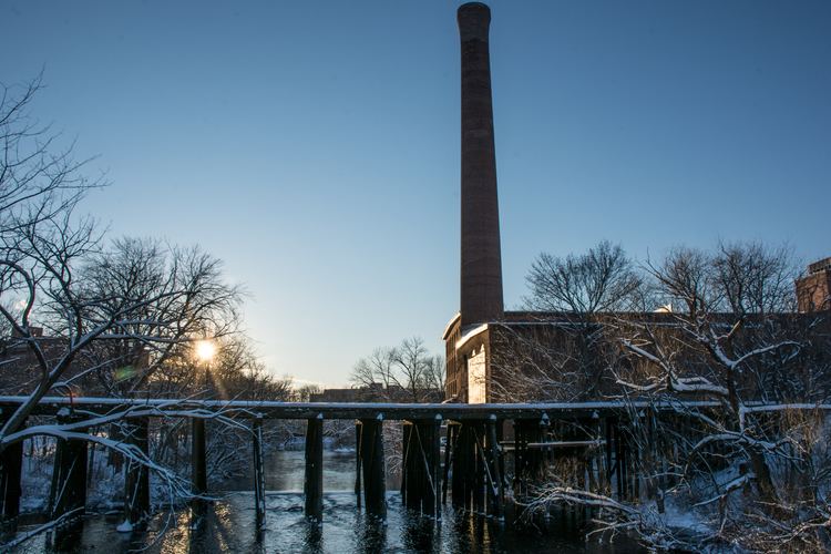
The western portion of the branch continued past the Town Hall area, then headed southwest toward Main and Pleasant Streets (near Bacon and Howard Streets) and across Bridge Street in the Bemis Neighborhood of Watertown. Although much of the area has been built over, from there the line ran adjacent to Pleasant Street through what are now mainly parking lot areas, through the Quincy Cold Storage property (now Repton Place) on Pleasant Street, through the former Raytheon property in Waltham, and across River Street near Willow Street, before crossing the Charles River near the Bleachery Dam. The trestle for that crossing, approximately 140 years old, was dismantled and removed in August 2016. The line then crossed Calvary Street, then Newton Street, and proceeded across Pine Street before heading northwest, where it re-crossed the Charles, parallel to Elm Street. It then reached the Central Square area, and looped back into the Fitchburg Railroad main line.