
Country Canada Time zone MST (UTC-7) highways Hwy 5 Population 88 (2011) | Area code(s) 403 / 587 Elevation 1,280 m | |
 | ||
Weather 2°C, Wind SW at 11 km/h, 85% Humidity Improvement District Improvement District No. 4 Waterton | ||
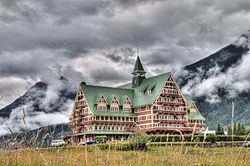
Waterton Park, commonly referred to as Waterton, is a hamlet in southwestern Alberta, Canada within Improvement District No. 4 Waterton (Waterton Lakes National Park).
Contents
Map of Waterton, AB, Canada
It is located at the southwestern terminus of Highway 5, approximately 54 kilometres (34 mi) west of the Town of Cardston and 55 kilometres (34 mi) south of the Town of Pincher Creek. This hamlet is north of Glacier National Park in Montana. It has an elevation of 1,280 metres (4,200 ft).
The hamlet is located in census division No. 3 and in the federal riding of Lethbridge.
Demographics
As a designated place in the 2016 Census of Population conducted by Statistics Canada, Waterton Park recorded a population of 105 living in 39 of its 168 total private dwellings, a change of 19.3% from its 2011 population of 88. With a land area of 485.66 km2 (187.51 sq mi), it had a population density of 0.2/km2 (0.6/sq mi) in 2016.
As a designated place in the 2011 Census, Waterton Park had a population of 88 living in 31 of its 181 total dwellings, a -45% change from its 2006 population of 160. With a land area of 480.58 km2 (185.55 sq mi), it had a population density of 0.1831/km2 (0.4743/sq mi) in 2011.