
Elevation −1 m (−3 ft) Time zone CET (UTC+1) Area code 0299 | Established 1 January 1991 Demonym(s) Waterlander Postcode 1140–1156, 1452–1454 Local time Sunday 12:11 PM | |
 | ||
Weather 16°C, Wind S at 11 km/h, 56% Humidity Area 115.7 km² (52.11 km² Land / 63.55 km² Water) | ||
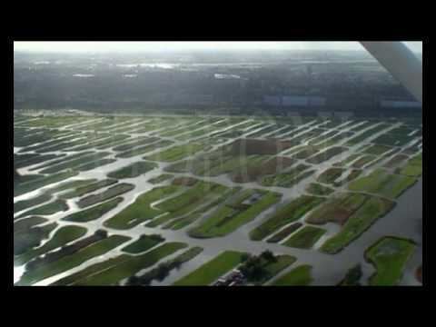
Amsterdam and waterland tour
Waterland ( pronunciation ) is a municipality in the Netherlands, in the province of North Holland. It is located north of Amsterdam, on the western shore of the Markermeer.
Contents
- Amsterdam and waterland tour
- Map of Waterland Netherlands
- Netherlands amsterdam and waterland
- Population centres
- Local government
- References
Map of Waterland, Netherlands
Netherlands amsterdam and waterland
Population centres
The municipality of Waterland consists of the following cities, towns, villages and/or districts: Broek in Waterland, Ilpendam, Katwoude, Marken, Monnickendam, Overleek, Uitdam, Watergang, Zuiderwoude.
Dutch Topographic map of the municipality of Waterland, 2013.
Local government
The municipal council of Waterland consists (2002) of 17 seats, which are divided as follows:
References
Waterland Wikipedia(Text) CC BY-SA