
Population 9,915 (2012) | Postal code 1140–1141 Local time Thursday 1:33 PM Area code 0299 | |
 | ||
Weather 16°C, Wind SW at 24 km/h, 58% Humidity | ||
4k one hour window monnickendam the netherlands holland amsterdam
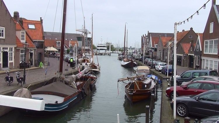
Monnickendam ( [ˌmɔnɪkənˈdɑm]) is a city in the Dutch province of North Holland. It is a part of the municipality of Waterland, and lies on the coast of the IJsselmeer, about 8 km southeast of Purmerend. It received city rights in 1355 and suffered a lot of damage during the fires of 1500 and 1513.
Contents
- 4k one hour window monnickendam the netherlands holland amsterdam
- Map of Monnickendam Netherlands
- History
- Demographics
- Notable residents
- References
Map of Monnickendam, Netherlands
History
Monnikendam was also the name of a number of warships - mainly built at the port of that name - during the Anglo-Dutch Wars.
The town was founded by monks, the name Monnickendam translates as 'Monk's dam'.
Monnickendam was a separate municipality until 1991, when it was merged into Waterland. Although it is a small fishing village today, it was an important port in earlier centuries. It possesses a seventeenth-century weigh house, once used by merchants and port officials, and a bell tower that dates from 1591. The fourteenth century church of St. Nicholas, renovated in 1602, is particularly notable. The synagogue was built in 1894. Jewish families named Monnikendam trace their roots to this town.
The town was the site of an artist's colony in the early twentieth century.
Demographics
In 2001, the town of Monnickendam had 9,546 inhabitants. The built-up area of the town was 1.34 km², and contained 3,766 residences. The wider statistical area of Monnickendam has a population of around 9,680.