
Postcode(s) 4133 Waterford West Bethania | Postal code 4133 Population 6,160 (2011 census) | |
 | ||
Location 28 km (17 mi) from Brisbane GPO | ||
Waterford West is a residential suburb of Logan City, Queensland, Australia. The eastern boundary and part of the southern boundary follow the course of the Logan River. At the 2011 Australian Census the suburb recorded a population of 6,160.
Contents
Map of Waterford West QLD 4133, Australia
The suburb is home to Marsden State High School in the west.
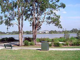
It has a shopping centre called Waterford Plaza close to a road bridge across the Logan. Around this area the main roads, Kingston Road and Loganlea Road intersect. The area currently has some retail development as well as historical significance to Logan City. The centre adjoins a large lagoon known as Tygum Lagoon.
Demographics
In the 2011 census, Waterford West recorded a population of 6,160 people, 51.2% female and 48.8% male. The median age of the Waterford West population was 33 years, 4 years below the national median of 37. 66.8% of people living in Waterford West were born in Australia. The other top responses for country of birth were New Zealand 8.7%, England 4.9%, Philippines 0.9%, Samoa 0.8%, Fiji 0.7%. 81.5% of people spoke only English at home; the next most common languages were 2% Samoan, 1.3% Khmer, 0.8% Romanian, 0.6% Hindi, 0.5% Tagalog.