
Population 6,172 (2011 census) | Postcode(s) 4131 Postal code 4131 | |
 | ||
Location 27 km (17 mi) from Brisbane GPO | ||
Loganlea is an urban, residential suburb of Logan City, Queensland, Australia. the 2011 Australian Census the suburb recorded a population of 6,172. The eastern boundary of Loganlea is marked by a winding section of the Logan River. The north of the suburb is aligned with the Beenleigh railway line. The western boundary follows part of both Scrubby Creek and Kingston Road. The Logan Motorway crosses the northern tip of Loganlea where access is provided via Kingston Road.
Contents
Map of Loganlea QLD 4131, Australia
Loganlea State High School was built in the north-east close to the railway line. A police beat is located on the corner of Haig Road and Station Street. Towards the centre of the suburb is a small retail zone which includes a child-care centre. The Logan Artists Association art gallery and studio opened in 2012 and is located in Coral Street. In the east along Logan River the land is prone to flooding. Flooding is experienced at Loganlea Road near Webb Road when the Logan River breaks its banks. Evergreen Park and Sturdee Park are two large parks amongst many smaller others.
There are power transmission lines along Scrubby Creek connected to the Loganlea Substation nearby in Meadowbrook . The suburb is very close to Logan Hospital, TAFE college and Griffith University in Meadowbrook and a shopping centres in both Marsden and Waterford West.
History
What is now Loganlea is much smaller than the original area between Slacks Creek and Waterford. In 1864, flooding of the Logan River lead to several casualties. In 1871, the first post office in the area was opened in what is today part of Waterford West. A hotel and Cobb and Co stop were established in the vicinity. By 1876 a crossing of the Logan River to Waterford. Like a number of other Logan City suburbs Loganlea was once part of the Shire of Tingalpa.
The Loganlea railway station opened in 1885 for the South Coast railway line. Later in the same year the bridge across the Logan River was opened. Initial housing developments occurred in the 1970s and 80s. Meadowbrook was detached from the former dairy farming community of Loganlea in 1991.
Demographics
Housing in the suburb is mix of aged care facilities, newer high density housing, average sized blocks with detached houses and houses on established, larger blocks. Like many central Logan suburbs Loganlea is experiencing significant population growth. Between 2006 and 2011 the population grew by 16.6%.
At the 2011 Australian Census the suburb had a population rate for Aboriginal and Torres Strait Islander people of 5.8%, more than double the national average of 2.5%. A greater proportion of families are composed of one parent at 28.1%, almost double the national rate of 15.9%. A clear majority of dwellings in Loganlea are detached or separated houses.
Part of the suburb was contained with a planning area in an October 2011 local government report. High density housing surrounding Logan railway station will be permitted though development applications up to six stories in height.
In the 2011 census, Loganlea recorded a population of 6,172 people, 51.4% female and 48.6% male. The median age of the Loganlea population was 30 years, 7 years below the national median of 37. 66.2% of people living in Loganlea were born in Australia. The other top responses for country of birth were New Zealand 8.2%, England 3.1%, Philippines 1%, Fiji 1%, Kiribati 0.9%. 78.9% of people spoke only English at home; the next most common languages were 1.6% Samoan, 1.2% Khmer, 1.2% Hindi, 1% Gilbertese, 0.7% Spanish.
Transport
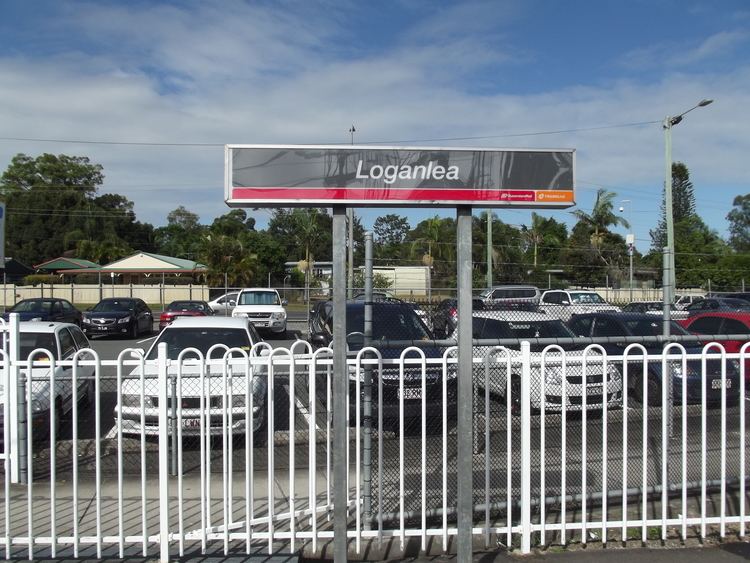
Loganlea railway station provides access to regular Queensland Rail City network services to Brisbane, Beenleigh and Gold Coast. Loganlea Road and Station Road are two arterial roads in Loganlea. Haig Road, Station Road and Monash Road are the suburb's main connecting roads. A road overpass for the Beenleigh rail line was built just south of the railway station. Street parking in some areas near the railway station is limited two hours.
The station is one two stops in the Logan City area serviced by the Gold Coast railway line. These partial express service trains arrive in the city in around 30 minutes in the off peak period. Logan Bus Service operates a number of services, including late at night, through more than a dozen bus stops throughout the suburb. They also operate a bus depot in Jutland Street.
The Slacks Creek Cycle Way passes adjacent to Loganlea Road across the suburb. The East West route cycleway to Kingston and Marsden winds around Scrubby Creek close to the suburb's northern boundary.