
Time zone SAST (UTC+2) Municipal code DC36 Mayor Rosina Mokgotlane | Area 44,913 km² | |
 | ||
Destinations Madikwe Game Reserve, Bela‑Bela, Marakele National Park, Lephalale, Modimolle Points of interest Hetbad Nature Reserve, Aruba Water World Re, Welgevonden Game Reserve, Matimba Power Station, Tlopi Tented Camp | ||
Waterberg is one of the 5 districts of Limpopo province of South Africa. The seat of Waterberg is Modimolle. The majority of its 614 139 people speak Northern Sotho (2001 Census). The district code is DC36.
Contents
- Map of Bosveld South Africa
- Geography
- Neighbours
- Local municipalities
- Demographics
- Election results
- References
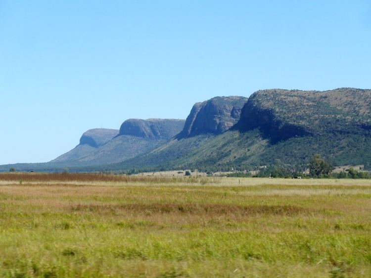
Map of Bosveld, South Africa
Geography
The municipality contains much of the Waterberg Biosphere, a UNESCO designated Biosphere Reserve. The Waterberg Biosphere is a massif of approximately 15,000 square kilometers. Waterberg is the first region in the northern part of South Africa to be named as a Biosphere Reserve by UNESCO. The extensive rock formation was shaped by hundreds of millions of years of riverine erosion to yield diverse bluff and butte landform. The ecosystem can be characterised as a dry deciduous forest or Bushveld. Within the Waterberg there are archaeological finds dating to the Stone Age, and nearby are early evolutionary finds related to the origin of humans.
The following sets forth neighboring municipalities and principal municalities within the Waterberg District Municipality:
Neighbours
Waterberg is surrounded (clockwise) by:
Local municipalities
The district contains the following local municipalities:
Demographics
The following statistics are from the 2001 census.
Election results
Election results for Waterberg in the South African general election, 2004.