
Overlap shared by surface water and groundwater 140 km (34 cu mi) Groundwater recharge 140 km3 (34 cu mi) Hydropower generation 40% | Renewable water resources 922 km3 (221 cu mi) Surface water produced internally 884 km3 (212 cu mi) | |
 | ||
Wetland designated as Ramsar sites 159,154 ha (393,280 acres) Renewable water resources per capita 54,868 m3/a (61,400 cu ft/Ms) Withdrawals by sector 2000 Domestic: 11%; Agriculture: 63%; Industry: 25% | ||
Water Resources Management (WRM) in Chile is widely known for its 1981 Water Code—written after General Augusto Pinochet took control through a military coup d'état. Free-market mechanisms became the economic philosophy in WRM, including the development of water markets and tradable water permits. A major reform to the 1981 Water Code was signed in 2005 to address social equity and environmental protection concerns. Water resources management in Chile is shared among the private sector which provides investment for infrastructure and distribution, and agencies provide regulatory oversight, maintain records, and issue water rights. Chile is negotiating formalized agreements with both Bolivia and Argentina to manage shared resources and water storage projects. Chile is also supported in rural water supply with $150 million in loans by the World Bank and the Inter-American Development Bank.
Contents
- Surface and groundwater resources
- Storage capacity
- Droughts and floods
- Water quality
- Legal framework
- Institutional framework
- International agreements
- Potential climate change impacts
- Aquatic ecosystems
- Virtual export of water
- References
Chile has three distinct hydrological regions:
- The dry northern regions, including the Atacama Desert, one of the driest places on earth
- The central regions are temperate and support the largest population centers of Santiago and Valparaíso
- The sparsely populated southern provinces receive large quantities of rain and snow.
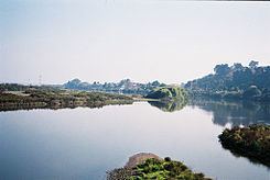
There are a number of important rivers in Chile. The longest river in Chile, the Loa River, is located in the Atacama Desert. The largest river by volume, the Rio Baker is found in the Aysén Region, of Patagonia, and the Biobío, a source of hydropower, and the Maipo supplies Santiago with water.
Water quality is quite good in Chile and is recognized for outstanding water supply and sanitation systems. The National Commission of the Environment (CONAMA) set a goal to treat 95% of wastewater by 2010. Point source pollution from mining effluent and nonpoint source agricultural runoff is a problem as untreated water discharges into lakes, rivers, and aquifers. Chile has improved in this area since the 1980 declaration to 'live in a pollution-free environment'.
Chile has increased exports of fruits and wine requiring improvements and growth in irrigation technology and management. Future hydroelectric projects on the Baker River are in planning stages and should help Chile cope with its energy demands. Hydroelectric projects generate 40% of Chile’s electricity. Copper mining is a major contributor to Chile's GDP and requires large volumes of water; thus creating contention between domestic uses for water and the needs to meet export demands of copper and fruits. Many glaciers exist in Chile and climate change is increasing the rate of melting. As melting continues, experts agree that hydropower, irrigation, and water supply for human consumption may be diminished.
Surface and groundwater resources
Chile is characterized by irregular distribution of rainfall totals among three distinct climate regions: the Atacama Desert in the northern region, the temperate and Mediterranean central region, and the cold and rainy southern region. The dry Atacama Desert region receives an average of 44.5 mm of precipitation annually while the southern regions receive 3000 mm of annual precipitation on average. According to FAO, average annual precipitation is 1,522 mm with an annual volume of 1,152 km3. From this total volume, 884 km3 will runoff while 268 km3 will evaporate from rivers, lakes and reservoirs.
Chile's rivers are generally short, running from the Andes in the East to the Pacific in the West. The most important rivers in Chile are the Loa River in the Northern Atacama desert, the country's longest river with a length of 420 km that has suffered pollution from copper mining; the Baker River in Patagonia, the country's largest river in terms of discharge that is the site of Chile's largest planned hydropower plant with a capacity of 2,400 Megawatts; the Biobío River, the country's second longest river that became famous for the construction of controversial Pangue Dam in 1996; the Maule River in the central part of Chile that is well known for its agriculture, including its irrigated vineyards, as well at the literature and poetry it has inspired; and the Maipo River that provides the capital Santiago with drinking water and is also a major source of water for irrigation.
Groundwater usage from aquifers in Chile is notably much less than of surface water. As of 1999, only 1.455 km3 was pumped out of aquifers that are recharged by nine prominent watersheds in Chile.
The table below further distinguishes among fifteen administrative regions of Chile and their main hydrological characteristics.
Regions I through XV correspond to Northern Chile (drier) down to Southern Chile (wetter) respectively. NOTE: *Region XIV is between IX and X; ** Region XV is northernmost.
Source for tables above: FAO (2000) data updated with 2002 census figures; ***The Global Precipitation Climatology Project (GPCP) (2006)
Storage capacity
Artificial storage. Chile has an artificial reservoir capacity of 4.66 km3, of which 4.2 km3 is stored behind large dams. Approximately 0.5 km3 is stored behind smaller public works dams. A majority of the stored water in these reservoirs is located within three of the fifteen regions. Regions IV, VI, and VII (from table above) account for approximately 80% of Chile’s artificial surface water storage.
(See also List of lakes in Chile)
Natural storage. Chile has a large number of natural lakes with an approximate capacity of 7 km3. The southern regions are home to numerous lakes and lagoons, some shared with Argentina. Population density is very low in southern Chile (0.1 to 0.6 persons/km2), therefore demand for water and development of the water resources is minimal.
Droughts and floods
In the central and most populous regions of Chile rainfall is highly variable, resulting in occasional floods and droughts. In early 2008 one of the worst droughts to hit Chile in decades forced the government to declare an emergency. 50 farming districts in central Chile were affected and farmers were forced to irrigate with dwindling groundwater. Some reservoirs for hydroelectric dams were at an all-time low. While 2008 was one of the worst droughts on record for the central regions, southern regions such as La Araucania, Biobío, and Los Rios Region also received torrential rain for more than three consecutive days in September 2008 causing severe flooding and the declaration of another emergency.
Water quality
In Northern regions of Chile, point source pollution from mining effluent is a problem. Because there is not much water in rivers, dilution of contaminants is greatly reduced. In Central Chile industrial pollution is an issue. Very often these discharges go untreated directly into river basins, lakes, and irrigation channels. Nonpoint source pollution from agricultural runoff including nitrates from fertilizers and untreated sewage is contaminating underground waters. The severity of the problem has yet to be thoroughly quantified.
Legal framework
The 1981 Water Code designated water as national property for use by the public and is uniquely noteworthy for establishing transferable water use rights and innovative use of market mechanisms to distribute water rights to users. Reform of the 1981 Water Code began in 1992, and over the course of thirteen years, politicians conducted over 300 long and laborious meetings, engaged in over 50 technical and legal studies, and met with stakeholders several hundred times before the reform was finalized and passed in 2005.
A relevant sidenote, US trained free-market economists instrumental in re-writing Chilean laws in the 1970s known as the “Chicago Boys”, advised the Chilean government that market mechanisms could perhaps motivate users to save water, sell their surplus, and transfer water rights to higher value users in other sectors.
In 2014 senators led by Senator Pedro Araya from the dry Antofagasta region launched an initiative to amend the constitution to "nationalize water resources".
Institutional framework
General Water Directorate (DGA)- The DGA is a regulatory body under the Ministry of Public Works. Their management tasks include facilitating the operation of the system, maintaining hydrological data and a water cadastre, enforces national water policy, and keeping track of water rights information.
Maintained by the DGA, the Water Cadastre contains information on all water use rights granted by the DGA. Additionally, the water cadastre contains hydrological and water quality data, information on water user associations (WUA's), water withdrawals, and all other transactions. According to Robert R. Hearne and Guillermo Donoso, this cadastre does not imply legal title and often is incomplete.
Water Works Directorate (DOH)- Under the Ministry of Public Works, the DOH is responsible for the direction of the Rural Water Supply Program. Additionally, the DOH provides assistance in the construction and maintenance of major water supply including irrigation and drainage infrastructure.
National Commission of the Environment (CONAMA)- This commission serves as a coordinator of national environmental policy, water quality, and environment conservation. In the case of water quality management, CONAMA has established emission standards for discharges of wastewaters into sewerage systems, surface and groundwater and enforcement policies, penalties and fines for non compliance.
Superintendent of Sanitary Services (SISS)- This is a regulation and auditing agency of providers of drinking water and sanitation services in urban areas. SISS sets rates for sanitary services for the economy ministry, oversees compliance with norms, and regulates the control of environmental waste.
National Irrigation Commission (CNR)- Created in 1975, CNR is a legal body under public law. The primary objective of CNR is to develop and improve irrigation and drainage infrastructure throughout Chile.
A historical snapshot of Legal and Institutional Changes in the Water Sector (1977–2005):
Source: Peña, Humberto. Ministry of Public Works : Chile
International agreements
With Argentina. In 1991, an environmental treaty between Chile and Argentina was signed and within the treaty there is a "Protocolo de acuerdo" or framework agreement regarding shared water resources between the two countries. The framework agreement seeks to regulate the 'non-transfer" of pollution through waterways (rivers, aquifers,lakes, pipes) from one country to the other. This agreement, while it has not yet become effective is still considered by the FAO to be a global framework on negotiating this kind of agreement. In May 2009, representatives from Argentina and Chile met to formalize a request to their respective Ministers of Foreign Affairs. The request asks that the objectives of the 1991 protocol of shared water resources be complied with. Objectives in Article I of the protocol state, "the parties shall agree that the actions and programs concerning the use of shared water resources be undertaken under the concept of integrated management of the watersheds."
With Bolivia. Historically, there had not been agreements regarding water resources with Peru or Bolivia. Furthermore, Bolivia and Chile have been feuding over the use of the Silala waters for many years. Bolivian officials allege that because the Silala waters are born from 94 springs in Bolivia, it should be compensated by Chile for their use of the water. Chile and Bolivia were reported to be close to an initial agreement following a meeting in Santiago on April 3, 2009. The agreement would require Chile to pay for 50% of the Silala waters, to be paid by Chile's state copper company Codelco and by Ferrocarril Andino, a Chilean group investing in rail. Additionally, Bolivia's foreign relations minister David Choquehuanca has proposed a daily extraction fee totaling about US$6 million per year. Talks have continued in May 2009 to advance details of the international water sharing agreement.
Potential climate change impacts
See also Glaciers of Chile
According to the British Foreign and Commonwealth office, Chile is the planet’s ninth most vulnerable country to climate change. This office adds, "glacial melt, shifts in rainfall patterns, expanding deserts, and greater frequency in El Niño will have an impact on water supply."
Much of Chile is dominated by the Andes Mountain range and many high altitude glaciers. With rising temperatures, the IPCC warns of increased melting for many of these glaciers, with some of them disappearing as early as 2020–2030. The Third Assessment Report from the IPCC indicate a critical situation for glaciers in neighboring countries such as Bolivia and Peru. The IPCC report goes on to say that glaciers in Chile are drastically reducing their volume at an increasing rate and that changes in temperature and humidity are the primary cause. In an article from Science Daily in March 2008, the news agency reports that, "if the inter-tropical glaciers of Chile, Argentina, and Colombia disappear, water availability and hydropower generation will be affected." Of the thirty test glaciers monitored in the Andes by the World Glacier Monitoring Service (WGMS) only Chile's Echaurren Norte glacier thickened between 2005 and 2006.
Offnews, a sustainable development news forum from Buenos Aires, has aggregated climate change reports and predictions from the IPCC, the World Economic Forum, the UN Economic Commission for Latin America and the Caribbean, the University of Chile, and the Chilean government. Projections in the reporting of Offnews indicate that most of Chile will see a sharp reduction in rainfall. The one exception to reduced rainfall is in northern Atacama desert where increased rainfall is projected.
Aquatic ecosystems
The 1981 Water Code did not account for environmental issues such as ecological flows for rivers and lakes and ambient water quality, however, the 2005 reform began to address minimum flows to protect aquatic species. It is not clear that lower flows in rivers adversely affect populations of aquatic species, but the Organisation for Economic Co-operation and Development (OECD) has analyzed the status of species in Chile and report that 41 of 44 vertebrate freshwater species are encountering conservation problems. Possible reasons include low environmental flows, climate change impacts, and mining effluents, but direct links have not been established. There are seven UNESCO biosphere reserves, nine Ramsar (convention on wetlands) sites, and three World Heritage Sites in a network of protected areas in Chile.
Ramsar sites in Chile:
Virtual export of water
In a Global Water Partnership article, "virtual transfer" of water out of Chile when exporting copper and fruit is substantial at around 1,900 million m3 per year. This equates to approximately 1.4 times the amount of drinking water produced per year in the country.