
Discharge 2.43 m³/s Bridges Viaducto De Conchi | Length 440 km Source Andes | |
 | ||
Main source near4,277 m (14,032 ft) Basin size 33,570 km (12,960 sq mi) Provinces El Loa, Tocopilla Province, Tamarugal Province, Iquique | ||
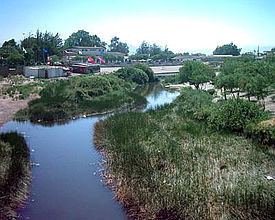
The Loa River (Spanish: Río Loa) is a U-shaped river in Chile's northern Antofagasta Region. At 440 km long it is the country's longest river and the main watercourse in the Atacama Desert.
Contents
Map of Loa River, Chile
Course
The Loa's sources are located on Andean mountain slopes at the foot of Miño Volcano. The upper Loa basin is flanked on the west by a ridge with elevations that reach above 4,500 m, whereas to the east lies a volcanic chain, which separates it from endorheic basins as that of Salar de Ascotán.
The river flows south on an elevated plateau, for about 150 km, to the oasis of Chiu Chiu (CHEE-oo CHEE-oo). The upper courses of the river are at a considerable elevation above sea level and receive a large volume of water from the Andes, mainly of two major tributaries: San Pedro de Inacaliri River and Salado River. The former joins the Loa near Conchi reservoir and the latter about 3 km south of Chiu Chiu. The water of its upper course and tributaries is fresh. However the lower course, as in all the rivers of this region becomes brackish.
From Chiu Chiu, the Loa flows west and north in a great curve to Quillagua (kee-YAH-gwah). After flowing for 115 km in this portion of its course and having run through the city of Calama, the Loa receives the waters of San Salvador River at the locality of Chacance. Thence the river flows north for about 80 km to Quillagua.
From Quillagua, its dry channel turns westward again and marks the border between the regions of Tarapacá and Antofagasta. Along its lower course, the Loa flows through a 500-m-deep canyon, which crosses the Chilean Coastal Range. The river reaches the Pacific Ocean in lat. 21° 26' S., a few miles south of the old port of Huanillos (Wan-EE-yōs).
The hydrologic regime of the river basin is rain-dominated. The increase of its water volume occurs mainly in January and February, as a consequence of the phenomenon known locally as Bolivian Winter.
History
Its banks have been inhabited from early times. Evidence of this is the notable number of geoglyphs, petroglyphs and pictographs that are found along its course and in its upper basin.
Another indication of its rich past is the Pukará de Lasana.
Bridges
To the south of Conchi reservoir, the river is spanned by an old railroad bridge, which is no longer used by the Ferrocarril de Antofagasta a Bolivia, however it still holds the notability of being, at 104 m, one of the highest bridges in Chile.
Needs
This river supplies many towns with water used to raise shrimp. Lately mining companies have been polluting this river making the water unusable.