
Length 24.17 km | ||
 | ||
North end: US 97 Alt. north of Entiat | ||
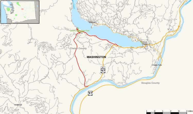
State Route 971 is a state highway in the U.S. state of Washington, running from US 97 Alternate west of Chelan to Lake Chelan State Park and back to US 97 Alternate farther southwest of Chelan. State Route 971 has the highest highway number in the state.
Contents
Map of WA-971, Chelan, WA 98816, USA
Route description
State Route 971 begins on the western shore of the Columbia River, at an intersection with U.S. Route 97 Alternate north of the town of Entiat. From there, the highway follows Navarre Coulee Road north, passing through Wenatchee National Forest. Approximately nine miles north of its southern terminus, the road curves to the east, where Navarre Coulee Road ends at South Lakeshore Road.
From this intersection, SR 971 follows South Lakeshore Road east along the southern side of Lake Chelan. (South Lakeshore Road also heads north from this intersection, serving two state parks, Lake Chelan and Twenty-Five Mile Creek.) Approximately six miles east of the intersection of these two roads, SR 971 ends back at US 97 Alternate, west of the town of Chelan.
History
Until 1987, SR 971 connected to US 97. US 97 followed the west bank of the Columbia River between Wenatchee and Stayman Flats Road (near the south end of SR 971). US 97 went inland to Lake Chelan and Chelan. State Route 151 followed the east bank of the Columbia River from Wenatchee to Chelan. In 1987, State Route 151 became US 97. US 97 became US 97 Alternate.
Major intersections
The entire highway is in Chelan County.