
Length 1.01 km | ||
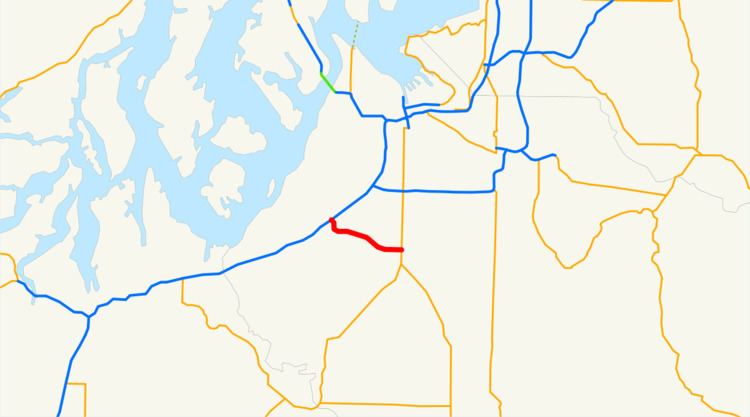 | ||
West end: Spanaway Loop Road near Spanaway West end Spanaway Loop Road near Spanaway | ||
State Route 704 (known as SR 704 or the Cross-Base Highway) is a 0.63-mile (1.01 km) long state highway located entirely in Pierce County, Washington. The current route starts at Spanaway Loop Road in Spanaway and ends at the intersection of SR 7 and 176th Street. The highway is scheduled to be 6 mi (9.7 km) long, connecting SR 7 to Interstate 5 in the west. The project, largely unfunded, is estimated to cost $480 million.
Contents
- Map of WA 704 Spanaway WA 98387 USA
- Route description
- Environmental lawsuit
- Future
- Major intersections
- References
Map of WA-704, Spanaway, WA 98387, USA
Route description
The current highway begins at the intersection of 176th Street and Spanaway Loop Road, paralleling the border of Joint Base Lewis-McChord, south of SR 704, as a multiple lane highway. The current alignment parallels the former 176th Street, which has been turned into a cul-de-sac at the west end and truncated at the east before the intersection and terminus of the current alignment at SR 7.
Environmental lawsuit
In July 2010, a coalition of local businesses, conservation organizations, and equestrian clubs filed a lawsuit against the Federal Highway Administration, WSDOT, and Pierce County to prevent construction of the proposed highway. Because the project has no funding and thus no construction schedule, the parties agreed to a stay of proceedings on October 15.
The coalition contended that the agencies failed to follow the Endangered Species Act, the National Environmental Policy Act, and failed to adequately consider reasonable alternatives. The coalition reports that the proposed highway would bisect the largest remnant oak woodland-prairie left in the Puget Sound area. The US Fish and Wildlife Service describes the area as "possibly the rarest habitat in North America," home to at least 29 species of federal and/or state threatened, endangered, candidate, and sensitive plant and animal species of concern, 18 of which are in the immediate vicinity of the proposed highway.
Drawing comparisons with Mt. Rainier National Park and Nisqually National Wildlife Area, Pierce County’s Biodiversity Network Assessment describes the area as “the most biologically and ecologically rich area remaining in the lower elevations of Pierce County.” The County predicts that these diverse habitats support 20 state or federally listed species, 24 Priority Habitat and Species, and 10 at-risk species, and dozens of other plants and animals.
The project's Environmental Impact Statement states,
The EIS also states that "By 2025, most of the freeway and arterial street systems will operate at [Level of Service] F conditions with volume/capacity (V/C) ratios well above 1.0." This means very heavy congestion and gridlock during most of the day.
Furthermore, the proposed highway will increase climate impacts by increasing driving distance. The EIS states that "Overall, people would travel a little farther to use the new Cross-Base Highway project to avoid other congested highways and arterials; this would increase miles driven."
A contrary view was expressed by Pierce County Executive John Ladenburg, who believes that it would be "environmentally irresponsible not to build that highway," because SR 704 will lessen development in the Puyallup Valley farmlands.
Future
The Washington State Department of Transportation (WSDOT) plans to extend the highway to be 6 miles (9.7 km) long, originating at Interstate 5 in the Tillicum neighborhood of Lakewood, Washington. A four-lane, divided highway with four intersections over its entire length, SR 704 may improve access to and between the military installations by providing an exclusive roadway between Fort Lewis and McChord AFB. It could also connect the developing industrial areas of DuPont and Frederickson as well as provide an east–west alternate thoroughfare to overcrowded State Route 512.
When voters rejected a November 2007 ballot measure which would fund the construction, most of the project was put on hold. However, on June 20, 2008, the WSDOT awarded a $7.35 million contract to Ceccanti Inc. for widening of the eastern 0.7 miles (1.1 km) of the route between Spanaway Loop Road and State Route 7. Groundbreaking was July 30, 2008. Assistant Project Engineer John Ho says that the project is scheduled to be completed by 2017 at the earliest.
The WSDOT puts the 2007 price tag for the highway at $480 million. However, only $43 million has been funded, requiring at least $437 million. Of this gap, only $50 million had been expected to be funded by a failed 2007 ballot initiative which in the end did not include the project.
These figures are expected to increase considerably due to rising costs of construction materials and fuel.
Major intersections
The entire route is in Pierce County.