
Counties: Grant | ||
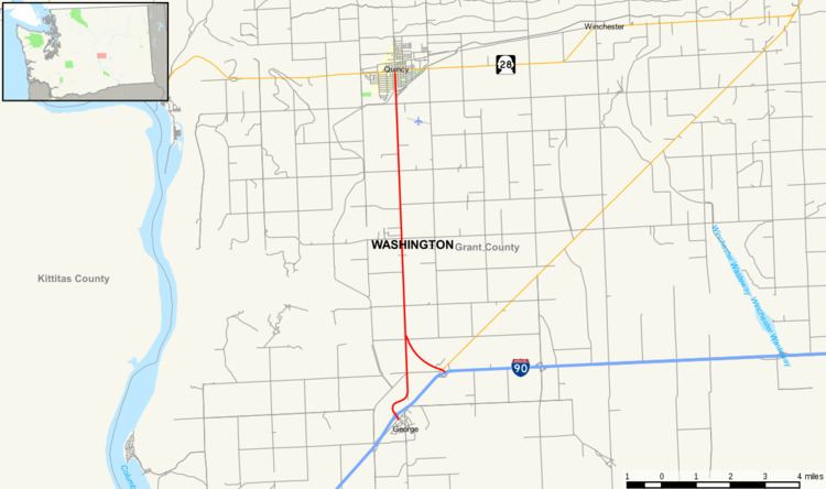 | ||
State Route 281 (SR 281) is a state highway in the U.S. state of Washington, connecting I-90 near George with SR 28 in Quincy.
Contents
Map of WA-281, Quincy, WA 98848, USA
Route description
SR 281 begins at a diamond interchange with exit 149 of I-90 just north of the city of George. The highway snakes through some farmland before turning north, and intersecting its spur route, which connects the highway back to I-90 in the south. Continuing north, the highway passes a weigh station while continuing through farmland. Passing west of the Quincy Municipal Airport, the highway continues north before terminating at an intersection with SR 28 in Quincy.
Every year the Washington State Department of Transportation (WSDOT) conducts a series of surveys on its highways in the state to measure traffic volume. This is expressed in terms of average annual daily traffic (AADT), which is a measure of traffic volume for any average day of the year. In 2009, WSDOT calculated that as many as 7,000 cars used the highway near the northern terminus at SR 28 and as few as 3,500 cars used the highway near the southern terminus at I-90.
The entire highway is listed on both the WSDOT List of Highways of Statewide Significance, which marks the highway as a critical to connecting major communities in the state, and the National Highway System, a system of roads that are important to the nation's economy, defense and mobility.
History
The first road that traveled south from Quincy was part of the Sunset Highway, first designated in 1915. By 1931, the highway was designated as part of Primary State Highway 7, which remained the highways designation until the 1964 renumbering, when the road's designation was changed to the current SR 281.
Major intersections
The entire route is in Grant County.
Spur route
A National Highway System listed 1.69-mile (2.72 km) long spur route connects SR 281 back to I-90 2.65 mi (4.26 km) from SR 281's southern interchange with I-90, and to SR 283. Between 2,000 and 3,600 cars travel on the highway on an average day.