
Existed: ca. 1939 – present Constructed 1964 | Length 57.68 km | |
 | ||
Counties | ||
State Route 22 (SR 22) is a 35.84-mile (57.68 km) long state highway spanning Yakima and Benton counties in the US state of Washington. Existing since at least 1937, the highway serves to connect several small communities that have been bypassed by Interstate 82 (I-82) / U.S. Route 12 (US 12). Except for the section through Toppenish and the southeastern bypass of Prosser, the highway is lightly traveled passing mainly through rural farmland. The highway parallels a BNSF Railway line for a majority of its route, with the rail line predating the highway by at least 27 years.
Contents
- Map of WA 22 Washington USA
- Route description
- History
- Related routes
- SR 220
- SR 221
- SR 223
- SR 224
- SR 225
- References
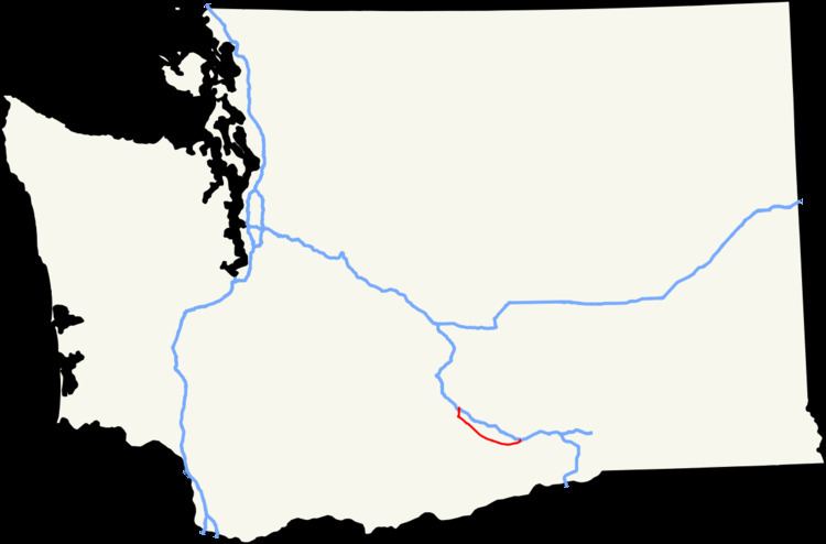
Map of WA-22, Washington, USA
Three digit highway numbers in Washington indicate auxiliary routes of their parent route, giving SR 22 five auxiliary routes: SR 220, SR 221, SR 223, SR 224, and SR 225. SR 220 was decommissioned during the 1991 legislative session, and is no longer maintained by the Washington State Department of Transportation.
Route description
SR 22 begins at exit 50 on the concurrent I-82 / US 12 as a hybrid diamond–partial cloverleaf interchange The route heads south through farmland towards the town of Toppenish in Yakima County, which is also part of the Yakama Indian Reservation. While in Toppenish, the highway passes over double track belonging to BNSF Railway. On the south end of town, SR 22 intersects US 97, turning southeast as US 97 heads south. Traveling southeast, SR 22 passes through more farmland, passing the small census-designated place of Satus and an interchange with SR 223. The city of Mabton is located just north of the highway, and is accessible by turning onto SR 241. The highway leaves the reservation and turns southwest after passing the Sunnyside Wildlife Recreation Area, and crosses the Yakima–Benton county line, continuing through farmland until approaching the outskirts of Prosser, the county seat of Benton County. SR 22 serves as a bypass of Prosser, turning north until intersecting Wine Country Road and the Desert Wind Winery on the east side of Prosser before turning back southwest on Wine Country Road and terminating at a folded diamond interchange, exit 82, on I–82.
Every year the Washington State Department of Transportation (WSDOT) conducts a series of surveys on its highways in the state to measure traffic volume. This is expressed in terms of average annual daily traffic (AADT), which is a measure of traffic volume for any average day of the year. In 2009, WSDOT calculated that as few as 1,100 cars traveled through the intersection with Bus Road just west of the Sunnyside Wildlife Recreation Area, and as many as 10,000 cars passed through the town of Toppenish before the interchange with US 97.
The segment of highway between its western terminus at I-82 and US 97 is listed on both the WSDOT List of Highways of Statewide Significance, which marks this portion of the highway as a critical to connecting major communities in the state, and the National Highway System, a system of roads that are important to the nation's economy, defense and mobility.
History
A roadway has existed since before 1926, connecting Toppenish and Prosser near the current alignment of SR 22, however the roadway was incomplete, with a gap existing between Satus and Mabton. The gap in the roadway was completed by 1933, and the segment between Toppenish and Prosser was numbered Secondary State Highway 3A (SSH 3A) by 1939, while the segment between the current I-82 and US 97 was originally numbered as part of Primary State Highway 8 (PSH 8). These designations remained until the 1964 state highway renumbering, when SSH 3A and the small segment of PSH 8 were renumbered SR 22. Before the completion of I-82 through the area, SR 22 continued into the town of Buena, however now that the interstate has been completed, SR 22 has been truncated to the interstate.
The rail line that the highway parallels between Toppenish and just west of Prosser has existed since at least 1910. It originally belonged to the Spokane, Portland and Seattle Railway, and it is now part of BNSF Railway as part of their Yakima Valley Subdivision.
In Spring 2011, WSDOT began a $4.63 million construction project to build wider lanes and shoulders on SR 22 between I-82 and the city of Toppenish, because of a number of collisions along the roadway. Other improvements included installing new sidewalks with ADA-compliant curbs and access ramps, as well as adding turn lanes to side roads. The project was completed in June 2012.
Related routes
Three digit state highway numbers are considered auxiliary routes of their one or two digit parent route, thus SR 22 has four current, and one decommissioned, auxiliary routes.
SR 220
State Route 220 was a 27.42-mile (44.13 km) long state highway located entirely in the Yakama Indian Reservation, Yakima County. The highway linked Fort Simcoe State Park in the west to White Swan and Toppenish in the east.
SR 221
State Route 221 is a 25.95-mile (41.76 km) long state highway located entirely within Benton County. The highway serves to connect the unincorporated community of Paterson to the county seat Prosser.
SR 223
State Route 223 is a 3.81-mile (6.13 km) long state highway located entirely in Yakima County. It serves the role of connecting the city of Granger to the county seat, Yakima via I-82 and to SR 22.
SR 224
State Route 224 is a 10.15-mile (16.33 km) long state highway located entirely in Benton County. The highway serves to connect SR 225 to I-82, and to link Benton City to West Richland and Richland.
SR 225
State Route 225 is an 11.32-mile (18.22 km) long two-lane state highway located entirely in Benton County. The highway travels over the Benton City – Kiona Bridge over the Yakima River and connects Benton City to I-82 via SR 224. The bridge is listed on the Washington Heritage Register and National Register of Historic Places.