
Existed: 1964 – present Length 3.7 km | Constructed 1964 | |
 | ||
State Route 128 (SR 128) is a Washington state highway located in Asotin and Whitman counties, west of the Idaho state line. The 2.30-mile (3.70 km) long route runs north from U.S. Route 12 (US 12) in Clarkston to cross the Snake River and turn east after intersecting SR 193 to terminate at State Highway 128 (SH 128) on the Idaho state line. The highway was originally created in 1964 on a Pomeroy–Clarkston route, replacing Secondary State Highway 3K (SSH 3K), which had been established in 1937; in 1991, the route was changed to its present form.
Contents
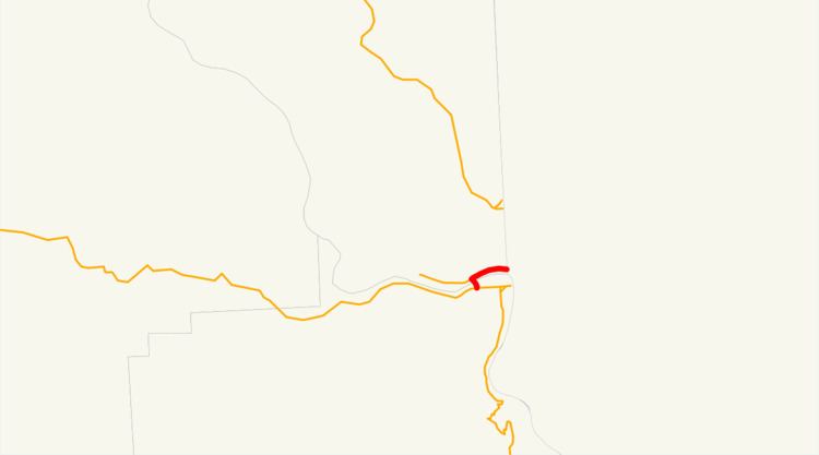
Map of WA-128, Washington, USA
Route description
State Route 128 (SR 128) begins at an intersection with U.S. Route 12 (US 12) in Clarkston, a city in Asotin County. The road then crosses the Snake River over the Red Wolf Crossing into Whitman County, where it crosses the Starbuck, WA–Spalding, ID route of the Great Northwest Railroad and intersects the eastern terminus of SR 193. At the SR 193 intersection, the highway turns east and continues to the Idaho state line, where it becomes Idaho State Highway 128 (SH-128); which continues for another 2.198 miles (3.537 km) before ending at US-12 north of Lewiston, Idaho. SR 128 after the US 12 intersection was used by 5,000 motorists daily in 2007 based on average annual daily traffic (AADT) data collected by the Washington State Department of Transportation.
History
The first highway that would later become SR 128 was Secondary State Highway 3K (SSH 3K), which was first designated in 1937. The road ran from Pomeroy in Garfield County southeast to Peola and later northeast to Clarkston, terminating at Primary State Highway 3 (PSH 3), co-signed with U.S. Route 410 (US 410) at both termini. During the 1964 highway renumbering, SSH 3K became SR 128, which ran 42.19 miles (67.90 km); the current route of the highway was occupied by SR 193, which was Secondary State Highway 3G from 1969 to 1970. In 1990, SR 193 was shortened from the Red Wolf Crossing to the Idaho state line, which SR 128 was extended over. A year after the extension to Idaho, SR 128 was shortened from Pomeroy to Clarkston along its current route, a loss of 42.19 miles (67.90 km) in total.