
Website WashingtonCountyKS.gov Founded 20 February 1857 | Largest city Washington Area 2,328 km² Population 5,629 (2013) Unemployment rate 3.1% (Apr 2015) | |
 | ||
Cities Rivers Little Blue River, Peats Creek, Cherry Creek | ||
Washington County (standard abbreviation: WS) is a county located in the U.S. state of Kansas. As of the 2010 census, the county population was 5,799. Its county seat and largest city is Washington.
Contents
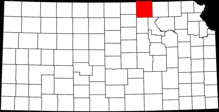
- Map of Washington County KS USA
- Early history
- 19th century
- 21st century
- Geography
- Demographics
- Law and government
- Education
- Washington County Schools USD 108
- Unincorporated community
- Townships
- References
Map of Washington County, KS, USA
Early history
For many millennia, the Great Plains of North America was inhabited by nomadic Native Americans. From the 16th century to 18th century, the Kingdom of France claimed ownership of large parts of North America. In 1762, after the French and Indian War, France secretly ceded New France to Spain, per the Treaty of Fontainebleau.
19th century
In 1802, Spain returned most of the land to France, but keeping title to about 7,500 square miles. In 1803, most of the land for modern day Kansas was acquired by the United States from France as part of the 828,000 square mile Louisiana Purchase for 2.83 cents per acre.
In 1854, the Kansas Territory was organized, then in 1861 Kansas became the 34th U.S. state. In 1857, Washington County was established.
21st century
In 2010, the Keystone-Cushing Pipeline (Phase II) was constructed north to south through Washington County, with much controversy over tax exemption and environmental concerns (if a leak ever does occur).
Geography
According to the U.S. Census Bureau, the county has a total area of 899 square miles (2,330 km2), of which 895 square miles (2,320 km2) is land and 3.9 square miles (10 km2) (0.4%) is water.
Demographics
As of the census of 2000, there were 6,483 people, 2,673 households, and 1,780 families residing in the county. The population density was 7 people per square mile (3/km²). There were 3,142 housing units at an average density of 4 per square mile (1/km²). The racial makeup of the county was 98.90% White, 0.11% Black or African American, 0.34% Native American, 0.05% Asian, 0.09% from other races, and 0.51% from two or more races. 0.65% of the population were Hispanic or Latino of any race.
There were 2,673 households out of which 26.60% had children under the age of 18 living with them, 59.40% were married couples living together, 4.20% had a female householder with no husband present, and 33.40% were non-families. 31.20% of all households were made up of individuals and 17.80% had someone living alone who was 65 years of age or older. The average household size was 2.35 and the average family size was 2.96.
In the county, the population was spread out with 23.70% under the age of 18, 5.40% from 18 to 24, 22.90% from 25 to 44, 23.00% from 45 to 64, and 25.10% who were 65 years of age or older. The median age was 44 years. For every 100 females there were 100.80 males. For every 100 females age 18 and over, there were 97.80 males.
The median income for a household in the county was $29,363, and the median income for a family was $37,260. Males had a median income of $25,074 versus $18,000 for females. The per capita income for the county was $15,515. About 7.30% of families and 10.10% of the population were below the poverty line, including 12.20% of those under age 18 and 12.40% of those age 65 or over.
Law and government
Washington County was a prohibition, or "dry", county until the Kansas Constitution was amended in 1986 and voters approved the sale of alcoholic liquor by the individual drink with a 30% food sales requirement.
Education
The county is served by:
Washington County Schools USD 108
The superintendent is Denise O'Dea. It includes:
Unincorporated community
Townships
Washington County is divided into twenty-five townships. The city of Washington is considered governmentally independent and is excluded from the census figures for the townships. In the following table, the population center is the largest city (or cities) included in that township's population total, if it is of a significant size.