
Website co.washington.ia.us Founded 1838 | Largest city Washington Area 1,479 km² Population 22,015 (2013) Unemployment rate 3.0% (Apr 2015) | |
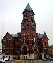 | ||
Points of interest Future Birthplace of Captai, City of Kalona, The Voyage Home Mu, Kalona Historical Village, Jonathan Clark Conger H | ||
Washington County is a county located in the U.S. state of Iowa. As of the 2010 census, the population was 21,704. The county seat is Washington.
Contents
- Map of Washington County IA USA
- History
- Geography
- Major highways
- Adjacent counties
- 2010 census
- 2000 census
- Education
- Unincorporated communities
- Population ranking
- References
Map of Washington County, IA, USA
Washington County is included in the Iowa, IA Metropolitan Statistical Area.
History
Washington County was originally formed on January 18, 1838 as Slaughter County in honor of William B. Slaughter, the secretary of Wisconsin Territory. The county, still named Slaughter County, became part of Iowa Territory on July 4, 1838 when it was organized. January 25, 1839, Slaughter County was renamed Washington County, in honor of George Washington. The first settlers arrived in Washington County in 1835. The homesteads did not start until 1836. A town was built in the present day township of Oregon named Astoria. It became the first county seat and housed the first court house. In 1839, Washington became the final location of the seat of justice.
The first religious society organized by Reverend J.L. Kirkpatrick, a Methodist reverend was created in 1839. The first newspaper was established in 1853; lasting only two years before crumbling. The very next year another newspaper was created, which is still viable today. The major waterways through Washington County are the Skunk and English Rivers and the Crooked Creek. Timber is found in abundance around these bodies of waters which helps in the major business of lumber. Soon after the year 1855, a bank was started in the city of Washington and other institutions followed soon after. No major increase in population happened until the year 1858 when the Mississippi and Missouri Railroad was finished through Washington.
Geography
According to the U.S. Census Bureau, the county has a total area of 571 square miles (1,480 km2), of which 569 square miles (1,470 km2) is land and 2.1 square miles (5.4 km2) (0.4%) is water.
Major highways
Adjacent counties
2010 census
The 2010 census recorded a population of 21,704 in the county, with a population density of 38.1636/sq mi (14.7350/km2). There were 9,516 housing units, of which 8,741 were occupied.
2000 census
As of the census of 2000, there were 20,670 people, 8,056 households, and 5,631 families residing in the county. The population density was 36 inhabitants per square mile (14/km2). There were 8,543 housing units at an average density of 15 per square mile (5.8/km2). The racial makeup of the county was 97.04% White, 0.29% Black or African American, 0.19% Native American, 0.25% Asian, 0.03% Pacific Islander, 1.51% from other races, and 0.68% from two or more races. 2.73% of the population were Hispanic or Latino of any race.
There were 8,056 households out of which 31.40% had children under the age of 18 living with them, 60.30% were married couples living together, 6.70% had a female householder with no husband present, and 30.10% were non-families. 26.40% of all households were made up of individuals and 12.50% had someone living alone who was 65 years of age or older. The average household size was 2.50 and the average family size was 3.04.
In the county, the population was spread out with 26.10% under the age of 18, 7.00% from 18 to 24, 26.80% from 25 to 44, 22.30% from 45 to 64, and 17.90% who were 65 years of age or older. The median age was 39 years. For every 100 females there were 93.00 males. For every 100 females age 18 and over, there were 90.10 males.
The median income for a household in the county was $39,103, and the median income for a family was $45,636. Males had a median income of $29,592 versus $22,818 for females. The per capita income for the county was $18,221. About 5.10% of families and 7.60% of the population were below the poverty line, including 10.30% of those under age 18 and 7.30% of those age 65 or over.
Education
The county is served by 3 school districts
Highland Community School District includes:
Unincorporated communities
Population ranking
The population ranking of the following table is based on the 2010 census of Washington County.
† county seat